 Old Cumbria Gazetteer
 |
 |
|
| Rawthey Bridge, Sedbergh | ||
| Rawthey Bridge | ||
| site name:- | Rawthey, River | |
| civil parish:- | Sedbergh (formerly Yorkshire) | |
| civil parish:- | Ravenstonedale (formerly Westmorland) | |
| county:- | Cumbria | |
| locality type:- | bridge | |
| coordinates:- | SD71349786 | |
| 1Km square:- | SD7197 | |
| 10Km square:- | SD79 | |
|
|
||
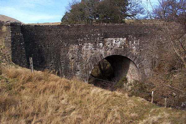 BLQ74.jpg (taken 4.3.2006) 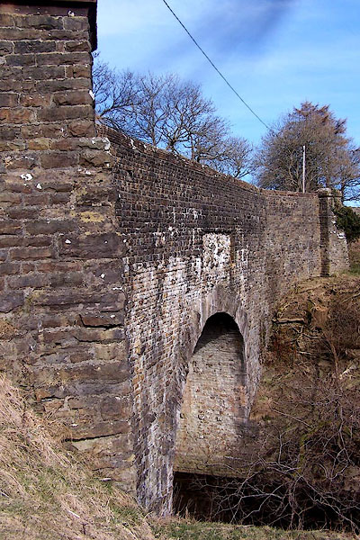 BLQ75.jpg (taken 4.3.2006) |
||
|
|
||
| evidence:- | old map:- OS County Series (Wmd 35 8) placename:- Rawthey Bridge |
|
| source data:- | Maps, County Series maps of Great Britain, scales 6 and 25
inches to 1 mile, published by the Ordnance Survey, Southampton,
Hampshire, from about 1863 to 1948. |
|
|
|
||
| evidence:- | old map:- Jefferys 1770 (Wmd) placename:- Roatha Bridge |
|
| source data:- | Map, 4 sheets, The County of Westmoreland, scale 1 inch to 1
mile, surveyed 1768, and engraved and published by Thomas
Jefferys, London, 1770.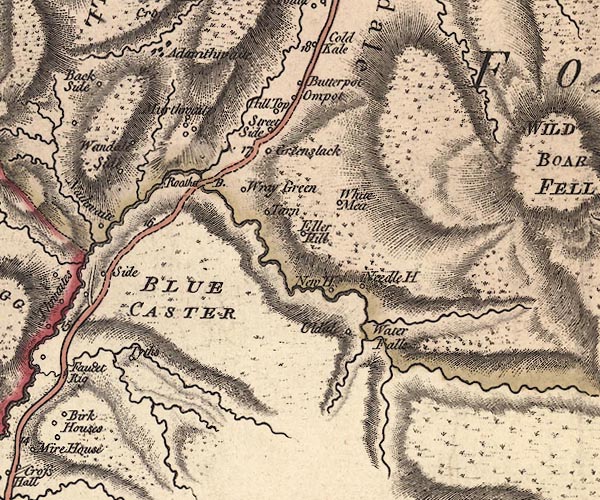 J5SD79NW.jpg "Roatha B." double line, road, across a stream; bridge item:- National Library of Scotland : EME.s.47 Image © National Library of Scotland |
|
|
|
||
| evidence:- | old map:- Cary 1789 (edn 1805) |
|
| source data:- | Map, uncoloured engraving, Westmoreland, scale about 2.5 miles
to 1 inch, by John Cary, London, 1789; edition 1805.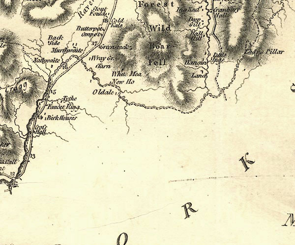 CY24SD79.jpg road across a stream; bridge over the Rawthey item:- JandMN : 129 Image © see bottom of page |
|
|
|
||
| evidence:- | road book:- Cary 1798 (2nd edn 1802) placename:- Rother Bridge |
|
| source data:- | Road book, itineraries, Cary's New Itinerary, by John Cary, 181
Strand, London, 2nd edn 1802. goto source goto source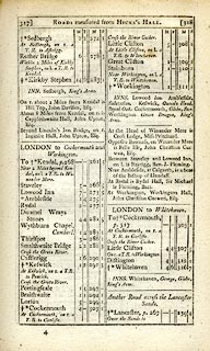 click to enlarge click to enlargeC38317.jpg page 317-318 "Rother Bridge" item:- JandMN : 228.1 Image © see bottom of page |
|
|
|
||
| evidence:- | old map:- Laurie and Whittle 1806 placename:- Rother Bridge |
|
| source data:- | Road map, Continuation of the Roads to Glasgow and Edinburgh,
scale about 10 miles to 1 inch, by Nathaniel Coltman? 1806,
published by Robert H Laurie, 53 Fleet Street, London, 1834. click to enlarge click to enlargeLw21.jpg "Rother Br." bridge; on county boundary item:- private collection : 18.21 Image © see bottom of page |
|
|
|
||
| evidence:- | database:- Listed Buildings 2010 placename:- Rawthey Bridge |
|
| source data:- | courtesy of English Heritage "RAWTHEY BRIDGE / / CAUTLEY ROAD / SEDBERGH / SOUTH LAKELAND / CUMBRIA / II / 484545 / SD7134297871" |
|
| source data:- | courtesy of English Heritage "Public road bridge. 1822, rebuilt after partial destruction of C16 bridge by floods. Coursed sandstone rubble. High semicircular arch with rubble voussoirs arranged in a saw-toothed pattern, a slightly raised keystone, and in the west side a wide rectangular panel as if for a tablet but containing only a small carved mask. Curved and battered abutments, straight parapets with sandstone copings. Flat deck." |
|
|
|
||
Lakes Guides menu.