 Old Cumbria Gazetteer
 |
 |
|
| Randalholm Hall, Alston Moor | ||
| Randalholm Hall | ||
| Randalholme | ||
| civil parish:- | Alston Moor (formerly Cumberland) | |
| county:- | Cumbria | |
| locality type:- | buildings | |
| coordinates:- | NY70804857 | |
| 1Km square:- | NY7048 | |
| 10Km square:- | NY74 | |
|
|
||
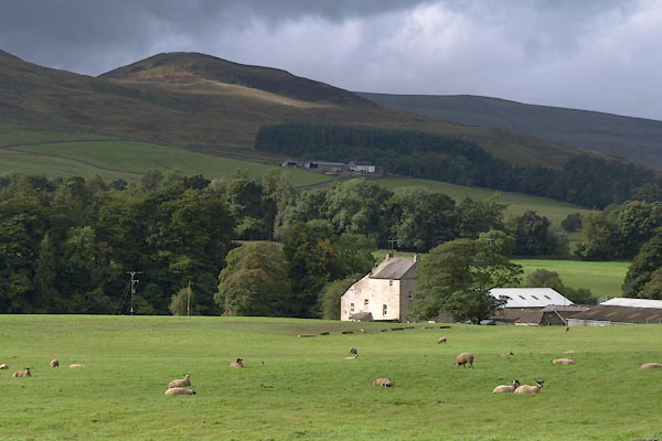 BXL10.jpg (taken 28.9.2012) 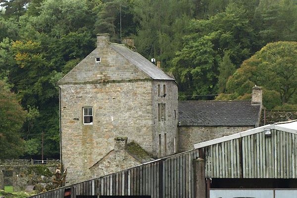 BXL11.jpg (taken 28.9.2012) |
||
|
|
||
| evidence:- | old map:- OS County Series (Cmd 33 8) placename:- Randalholm Hall |
|
| source data:- | Maps, County Series maps of Great Britain, scales 6 and 25
inches to 1 mile, published by the Ordnance Survey, Southampton,
Hampshire, from about 1863 to 1948. |
|
|
|
||
| evidence:- | old map:- Donald 1774 (Cmd) placename:- Randaleholm |
|
| source data:- | Map, hand coloured engraving, 3x2 sheets, The County of Cumberland, scale about 1
inch to 1 mile, by Thomas Donald, engraved and published by Joseph Hodskinson, 29
Arundel Street, Strand, London, 1774.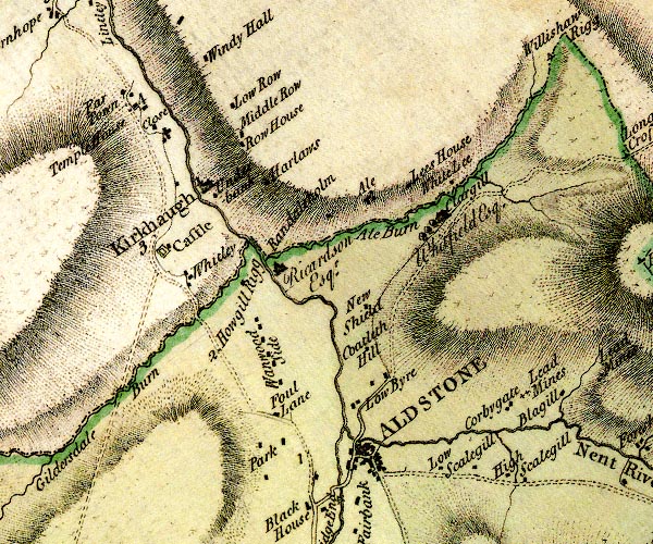 D4NY74NW.jpg "Randaleholm / Ricardson Esqr." house item:- Carlisle Library : Map 2 Image © Carlisle Library |
|
|
|
||
| evidence:- | site plan:- Curwen 1913 placename:- Randalholme |
|
| source data:- | Site plan, lithograh, Randalholme, Alston Moor, Cumberland, published for the Cumberland
and Westmorland Antiquarian and Archaeological Society by Titus Wilson, Kendal, Westmorland,
1913.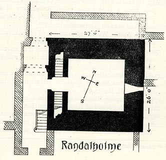 click to enlarge click to enlargeCW0162.jpg On p.311 of The Castles and Fortified Towers of Cumberland, Westmorland, and Lancashire North of the Sands, by John F Curwen. printed at bottom:- "Randalholme" item:- Armitt Library : A782.62 Image © see bottom of page |
|
|
|
||
| evidence:- | database:- Listed Buildings 2010 placename:- Randalholme Hall |
|
| source data:- | courtesy of English Heritage "RANDALHOLME HALL AND ADJOINING BYRE / / / ALSTON MOOR / EDEN / CUMBRIA / II / 73068 / NY7079748550" |
|
|
|
||
| notes:- |
pele tower, hall, bastle, etc |
|
| Perriam, D R &Robinson, J: 1998: Medieval Fortified Buildings of Cumbria: CWAAS::
ISBN 1 873124 23 6; plan and illustrations |
||
|
|
||
 Lakes Guides menu.