

placename:- Rachel Wood Mine
item:- Rachel Wood Vein; Francis Vein; East Ladstock Vein
 goto source
page 96:- "RACHEL WOOD MINE."
"The old men dug into the back of Rachel Wood Vein, high up in the Wood, nearly opposite Jenkin Hill and no doubt they obtained some ore."
"This vein contrary to the general rule, hades to the west."
"About the year 1875, a cross-cut was commenced by Captain Francis, 500 feet south-west, and at an elevation of 86 feet above the level of Thornthwaite Shaft top, but the work was discontinued before the vein was reached. This cross-cut was again commenced and pushed on by Messrs. Crewdson &Wilson, right into the heart of the mountain (Lord's Seat). Francis Vein was cut at a distance of 18 fathoms from the mouth of the cross-cut, Rachel Wood Vein at 20 fathoms, East Ladstock Vein at 24 fathoms and 35 fathoms, where the driving has stopped, it is believed to be in the vicinity of Ladstock Vein."
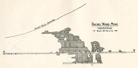
"The point where the cross-cut intersected Rachel Wood Vein was about the middle of a run of orey ground, about 45 fathoms in length; this ground was stoped out to a height of 25 fathoms above the level, and to a depth of 10 fathoms below it, a shaft having been sunk to that depth. The total length of level driven on Rachel Wood Vein being 176 fathoms, 112 fathoms south, and 64 fathoms north of the cross-cut."
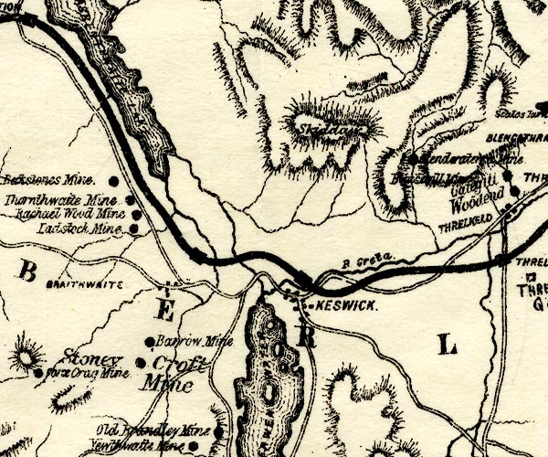
placename:- Rachael Wood Mine

PST2NY22.jpg
"Rachael Wood Mine"
mine symbol
item:- JandMN : 162.2
Image © see bottom of page
placename:- Rachel Wood Mine
 click to enlarge
PST319.jpg
On p.95 of Mines and Mining in the English Lake District, by John Postlethwaite.
printed, middle right "RACHEL WOOD MINE. / Longitudinal Section / SCALE 20 FM. TO 1 IN."
item:- JandMN : 162.21
Image © see bottom of page
placename:- Rachel Wood Mine
item:- Rachel Wood Vein; Francis Vein; East Ladstock Vein
 goto source
page 96:- "RACHEL WOOD MINE."
"The old men dug into the back of Rachel Wood Vein, high up in the Wood, nearly opposite Jenkin Hill and no doubt they obtained some ore."
"This vein contrary to the general rule, hades to the west."
"About the year 1875, a cross-cut was commenced by Captain Francis, 500 feet south-west, and at an elevation of 86 feet above the level of Thornthwaite Shaft top, but the work was discontinued before the vein was reached. This cross-cut was again commenced and pushed on by Messrs. Crewdson &Wilson, right into the heart of the mountain (Lord's Seat). Francis Vein was cut at a distance of 18 fathoms from the mouth of the cross-cut, Rachel Wood Vein at 20 fathoms, East Ladstock Vein at 24 fathoms and 35 fathoms, where the driving has stopped, it is believed to be in the vicinity of Ladstock Vein."
"The point where the cross-cut intersected Rachel Wood Vein was about the middle of a run of orey ground, about 45 fathoms in length; this ground was stoped out to a height of 25 fathoms above the level, and to a depth of 10 fathoms below it, a shaft having been sunk to that depth. The total length of level driven on Rachel Wood Vein being 176 fathoms, 112 fathoms south, and 64 fathoms north of the cross-cut."
placename:- Rachael Wood Mine

PST2NY22.jpg
"Rachael Wood Mine"
mine symbol
item:- JandMN : 162.2
Image © see bottom of page
placename:- Rachel Wood Mine
 click to enlarge
PST319.jpg
On p.95 of Mines and Mining in the English Lake District, by John Postlethwaite.
printed, middle right "RACHEL WOOD MINE. / Longitudinal Section / SCALE 20 FM. TO 1 IN."
item:- JandMN : 162.21
Image © see bottom of page
