 Old Cumbria Gazetteer
 |
 |
|
| Pull Woods, Skelwith | ||
| Pull Woods | ||
| civil parish:- | Skelwith (formerly Lancashire) | |
| county:- | Cumbria | |
| locality type:- | wood | |
| coordinates:- | NY365018 | |
| 1Km square:- | NY3601 | |
| 10Km square:- | NY30 | |
|
|
||
| evidence:- | perhaps old map:- Ogilby 1675 (plate 96) |
|
| source data:- | Road strip map, hand coloured engraving, the Road from Kendal to
Cockermouth, and the Road from Egremond to Carlisle, scale about
1 inch to 1 mile, by John Ogilby, London, 1675.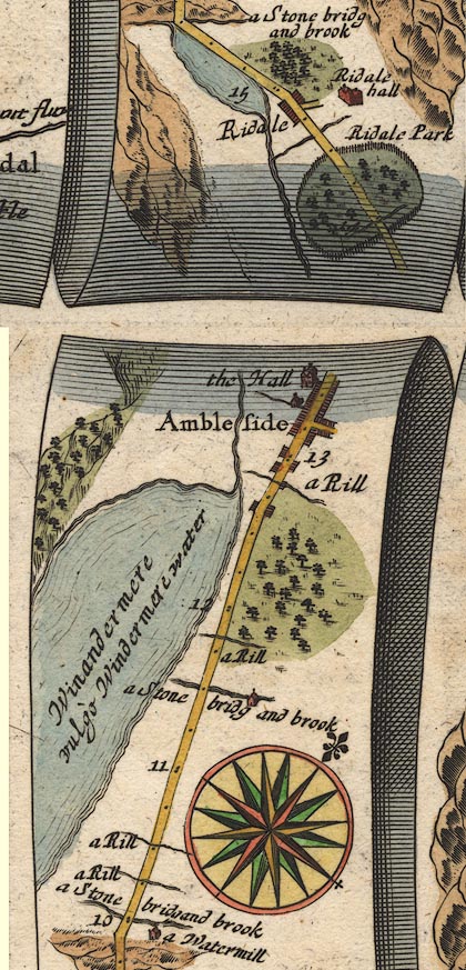 OG96m010.jpg In mile 12, Westmoreland. Wooded hill beyond the lake, left of the road. item:- JandMN : 22 Image © see bottom of page |
|
|
|
||
| evidence:- | old map:- Jefferys 1770 (Wmd) |
|
| source data:- | Map, 4 sheets, The County of Westmoreland, scale 1 inch to 1
mile, surveyed 1768, and engraved and published by Thomas
Jefferys, London, 1770.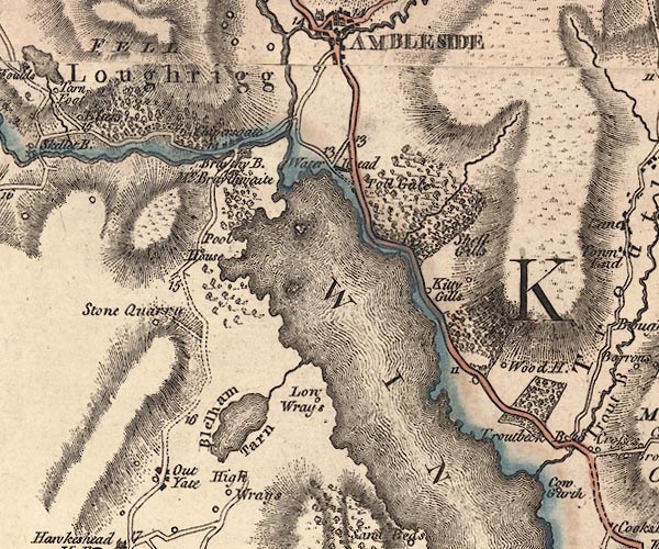 J5NY30SE.jpg trees; woodland item:- National Library of Scotland : EME.s.47 Image © National Library of Scotland |
|
|
|
||
| evidence:- | old map:- Clarke 1787 map (Windermere N) |
|
| source data:- | Map, A Map of the Northern Part of the Lake Winandermere and its
Environs, scale about 6.5 ins to 1 mile, by James Clarke,
engraved by Samuel John Neele, 352 Strand, published by James
Clarke, Penrith, Cumberland and in London etc, 1787.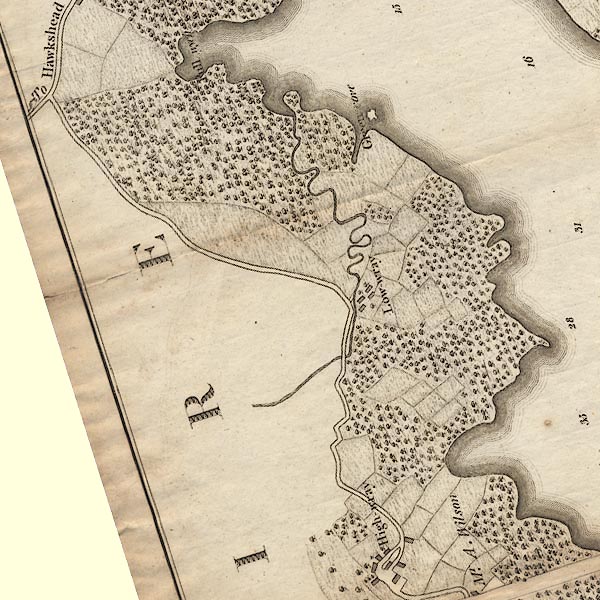 CLANY30Q.jpg item:- private collection : 10.10 Image © see bottom of page |
|
|
|
||
 Lakes Guides menu.