 Old Cumbria Gazetteer
 |
 |
|
| Powter How hill, Above Derwent | ||
| Powter How | ||
| civil parish:- | Above Derwent (formerly Cumberland) | |
| county:- | Cumbria | |
| locality type:- | hill | |
| coordinates:- | NY221267 | |
| 1Km square:- | NY2226 | |
| 10Km square:- | NY22 | |
|
|
||
| evidence:- | old map:- Crosthwaite 1783-94 (Bas) placename:- Powterhow |
|
| source data:- | Map, uncoloured engraving, An Accurate Map of Broadwater or
Bassenthwaite Lake, scale about 3 inches to 1 mile, by Peter
Crosthwaite, Keswick, Cumberland, 1783, version published 1800.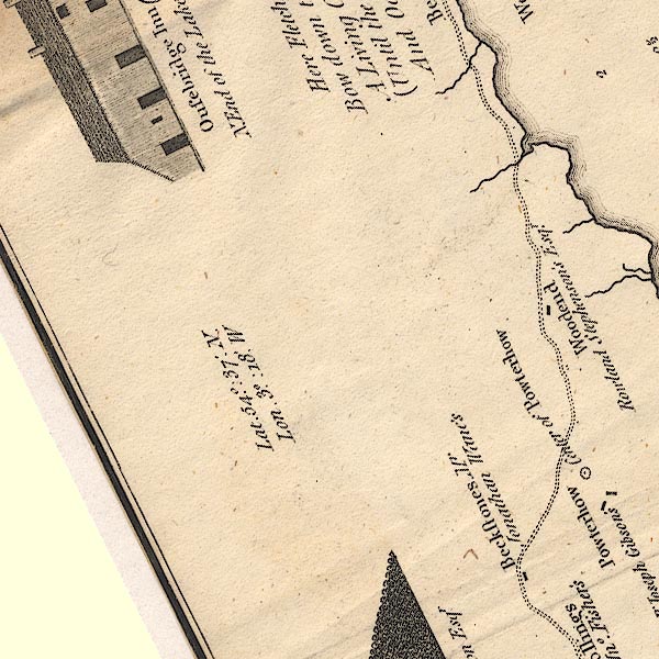 CT6NY22D.jpg "Centre of Powterhow" item:- Armitt Library : 1959.191.4 Image © see bottom of page |
|
|
|
||
| evidence:- | old map:- Crosthwaite 1783-94 (Bas) placename:- Powerthow |
|
| source data:- | Map, uncoloured engraving, An Accurate Map of Broadwater or
Bassenthwaite Lake, scale about 3 inches to 1 mile, by Peter
Crosthwaite, Keswick, Cumberland, 1783, version published 1800.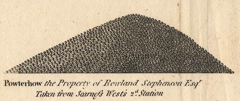 CT06Vgn2.jpg "Powterhow the Property of Rowland Stephenson Esqr. Taken from Scarness West's 2d. Station." item:- Armitt Library : 1959.191.4 Image © see bottom of page |
|
|
|
||
| evidence:- | old text:- Green 1810 placename:- Peterhow |
|
| source data:- | Set of prints, soft ground etchings, Sixty Studies from Nature,
by William Green, Ambleside, Westmorland, drawn 1808-10,
published 1810. goto source goto sourcepage 73:- "[round Bassenthwaite Lake] ... From Ouse Bridge, the road is by Peterhow, a rock covered with woods, ..." |
|
|
|
||
Lakes Guides menu.