 Old Cumbria Gazetteer
 |
 |
|
| Popping Stone, Waterhead | ||
| Popping Stone | ||
| civil parish:- | Waterhead (formerly Cumberland) | |
| county:- | Cumbria | |
| locality type:- | stone | |
| coordinates:- | NY63546815 | |
| 1Km square:- | NY6368 | |
| 10Km square:- | NY66 | |
|
|
||
 CGX15.jpg (taken 17.11.2017) 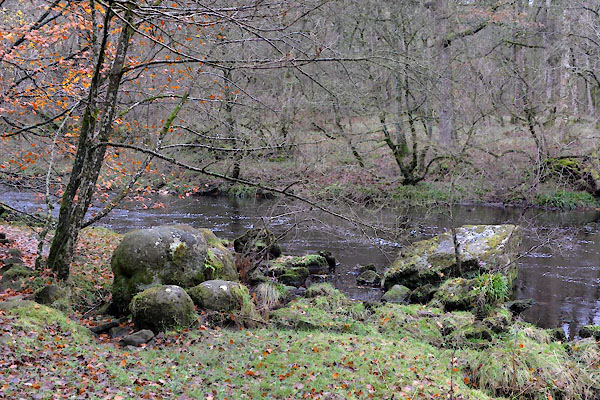 CGX16.jpg (taken 17.11.2017) |
||
|
|
||
| evidence:- | old map:- OS County Series (Cmd 13 5) placename:- Popping Stone |
|
| source data:- | Maps, County Series maps of Great Britain, scales 6 and 25
inches to 1 mile, published by the Ordnance Survey, Southampton,
Hampshire, from about 1863 to 1948. "Popping Stone" |
|
|
|
||
| evidence:- | old painting:- |
|
| source data:- | Painting, watercolour, the Popping Stone, Gilsland, Waterhead, Cumberland, by William
James Blacklock, 1840-58.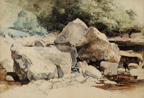 click to enlarge click to enlargePR0941.jpg The composition is dominated by detailed study of large rocks and boulders forming the bank of a mountain stream. Beyond stand trees and bushes in full leaf. item:- Tullie House Museum : 1946.67.7 Image © Tullie House Museum |
|
|
|
||
| hearsay:- |
Captain Scott of the Edinburgh Volunteers, later Sir Walter Scott, was staying at
the Shaws Hotel, Gilsland, July, 1797, and met Miss Charlotte Margaret Carpentier
when out riding one morning. He met her again at a ball at The Shaws. Shortly after,
walking out, he proposed to her at the Popping Stone. |
|
|
|
||
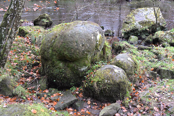
| hearsay:- |
The popping stone is a group of three boulders at the botton of the gorge of the River
Irthing. Sir Walter Scott may well have proposed there, but the stone already a known
landmark associated with courtship, and was already known as the popping stone - it
is not because he popped the question there. A local suggestion is that the stone
might be a megalithic monument. |
|
|
|
||
 Lakes Guides menu.