 Old Cumbria Gazetteer
 |
 |
|
| Ploveriggs, Crosby Ravensworth | ||
| Ploveriggs | ||
| civil parish:- | Crosby Ravensworth (formerly Westmorland) | |
| county:- | Cumbria | |
| locality type:- | buildings | |
| coordinates:- | NY59251654 | |
| 1Km square:- | NY5916 | |
| 10Km square:- | NY51 | |
|
|
||
| evidence:- | old map:- OS County Series (Wmd 14 11) placename:- Ploverigg |
|
| source data:- | Maps, County Series maps of Great Britain, scales 6 and 25
inches to 1 mile, published by the Ordnance Survey, Southampton,
Hampshire, from about 1863 to 1948. |
|
|
|
||
| evidence:- | probably old map:- Jefferys 1770 (Wmd) placename:- Plumrigg |
|
| source data:- | Map, 4 sheets, The County of Westmoreland, scale 1 inch to 1
mile, surveyed 1768, and engraved and published by Thomas
Jefferys, London, 1770.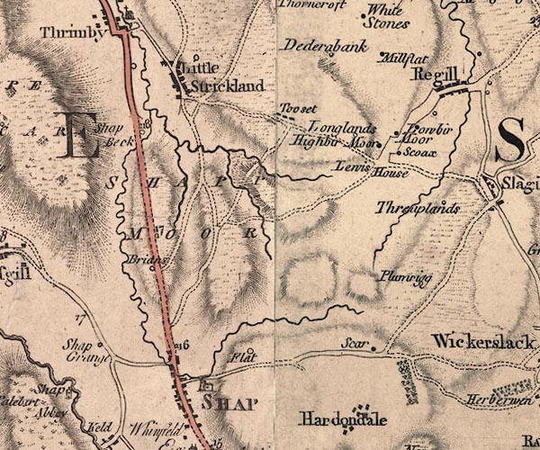 J5NY51NE.jpg "Plumrigg" circle, labelled in italic lowercase text; settlement, farm, house, or hamlet? item:- National Library of Scotland : EME.s.47 Image © National Library of Scotland |
|
|
|
||
| evidence:- | old map:- Cary 1789 (edn 1805) placename:- Plumrigg |
|
| source data:- | Map, uncoloured engraving, Westmoreland, scale about 2.5 miles
to 1 inch, by John Cary, London, 1789; edition 1805.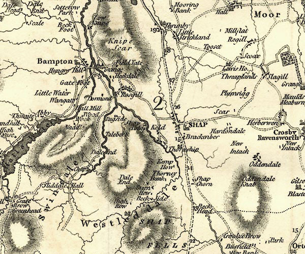 CY24NY51.jpg "Plumrigg" block/s, labelled in italic lowercase; house, or hamlet item:- JandMN : 129 Image © see bottom of page |
|
|
|
||
| evidence:- | database:- Listed Buildings 2010 placename:- Ploverigg Farm |
|
| source data:- | courtesy of English Heritage "PLOVERIGG FARMHOUSE / / / CROSBY RAVENSWORTH / EDEN / CUMBRIA / II / 74023 / NY5925116549" |
|
|
|
||
| evidence:- | database:- Listed Buildings 2010 item:- date stone (1763) |
|
| source data:- | courtesy of English Heritage "BARN AND BYRE RANGES ADJOINING SOUTH END OF PLOVERIGG FARMHOUSE / / / CROSBY RAVENSWORTH / EDEN / CUMBRIA / II / 74024 / NY5924616503" |
|
|
|
||
 Lakes Guides menu.