 Old Cumbria Gazetteer
 |
 |
|
| Plough Inn, Selside | ||
| Plough Inn | ||
| locality:- | Selside | |
| civil parish:- | Whitwell and Selside (formerly Westmorland) | |
| county:- | Cumbria | |
| locality type:- | buildings | |
| locality type:- | inn (ex) | |
| coordinates:- | NY53410001 | |
| 1Km square:- | NY5300 | |
| 10Km square:- | NY50 | |
|
|
||
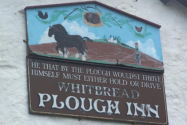 BMD12.jpg Innsign; a ploughman:- "'HE THAT BY THE PLOUGH WOULD'ST THRIVE / HIMSELF MUST EITHER HOLD OR DRIVE'" (taken 29.5.2006) 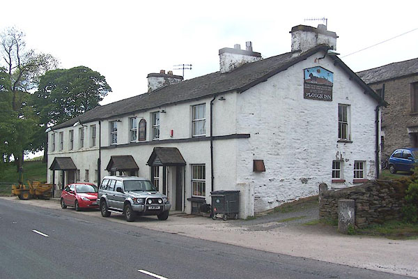 BMD10.jpg (taken 29.5.2006) |
||
|
|
||
| evidence:- | old map:- OS County Series (Wmd 34 1) placename:- Plough Inn |
|
| source data:- | Maps, County Series maps of Great Britain, scales 6 and 25
inches to 1 mile, published by the Ordnance Survey, Southampton,
Hampshire, from about 1863 to 1948. |
|
|
|
||
| evidence:- | probably old map:- Otley 1818 placename:- Plough |
|
| source data:- | Map, uncoloured engraving, The District of the Lakes,
Cumberland, Westmorland, and Lancashire, scale about 4 miles to
1 inch, by Jonathan Otley, 1818, engraved by J and G Menzies,
Edinburgh, Scotland, published by Jonathan Otley, Keswick,
Cumberland, et al, 1833.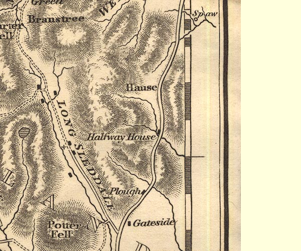 OT02NY50.jpg item:- JandMN : 48.1 Image © see bottom of page |
|
|
|
||
| evidence:- | old text:- Harper 1907 placename:- Plough |
|
| source data:- | Guidebook, The Manchester and Glasgow Road, by Charles G Harper,
published by Chapman and Hall Ltd, London, 1907. HP01p111.txt Page 111:- "..." "AT four miles and three quarters from Kendal, at Watchgate, the finest view opens, along Sleddale. Beyond it comes the "Plough" inn, with pictorial sign and the couplet -" "" "He that by the Plough would thrive," "Himself must either hold or drive." "a statement to which farmers do not unanimously subscribe." |
|
|
|
||
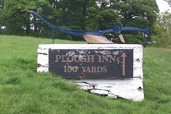 BMD11.jpg Innsign; a plough (taken 29.5.2006) |
||
|
|
||
 Lakes Guides menu.