 Old Cumbria Gazetteer
 |
 |
|
| pinfold, Sedbergh | ||
| site name:- | Pinfold Caravan Park | |
| locality:- | Sedbergh | |
| civil parish:- | Sedbergh (formerly Yorkshire) | |
| county:- | Cumbria | |
| locality type:- | pinfold | |
| coordinates:- | SD66679196 | |
| 1Km square:- | SD6691 | |
| 10Km square:- | SD69 | |
| SummaryText:- | At entrance to caravan park; carefully restored.. | |
| references:- | Dobbie, B M W: 1979: Pounds or Pinfolds and Lockups: Bath University Library (Bath,
Somerset):: ISBN 0 900843 34 9 |
|
|
|
||
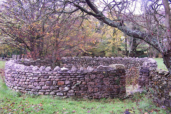 BJZ06.jpg (taken 4.11.2005) |
||
|
|
||
| evidence:- | old map:- OS County Series (Yrk 63 4) |
|
| source data:- | Maps, County Series maps of Great Britain, scales 6 and 25
inches to 1 mile, published by the Ordnance Survey, Southampton,
Hampshire, from about 1863 to 1948. "Pound" |
|
|
|
||
| evidence:- | old map:- OS County series (Yrk 63) |
|
| source data:- | "Pinfold" |
|
|
|
||
| hearsay:- |
The wall used to be higher. |
|
|
|
||
 Lakes Guides menu.