 Old Cumbria Gazetteer
 |
 |
|
| Peely Staplehold, Ullswater | ||
| Peely Staplehold | ||
| site name:- | Ullswater | |
| civil parish:- | Matterdale (formerly Cumberland) | |
| county:- | Cumbria | |
| locality type:- | rocks (?) | |
| coordinates:- | NY44812181 | |
| 1Km square:- | NY4421 | |
| 10Km square:- | NY42 | |
|
|
||
| evidence:- | old map:- OS County Series (Cmd 66 10) placename:- Peely Slapehold |
|
| source data:- | Maps, County Series maps of Great Britain, scales 6 and 25
inches to 1 mile, published by the Ordnance Survey, Southampton,
Hampshire, from about 1863 to 1948. |
|
|
|
||
| evidence:- | old map:- Clarke 1787 map (Ullswater) placename:- Peely Slapehold |
|
| source data:- | Map, A Map of the Lake Ullswater and its Environs, scale about
6.5 ins to 1 mile, by James Clarke, engraved by S J Neele, 352
Strand, published by James Clarke, Penrith, Cumberland and in
London etc, 1787.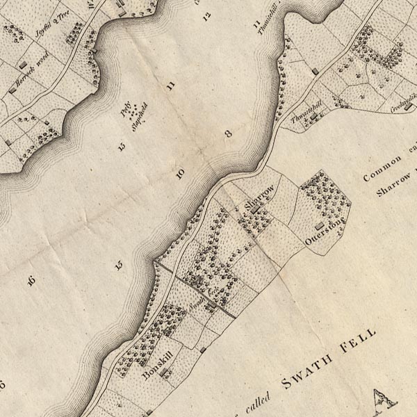 CL4NY42K.jpg "Peely Slapehold" Marked by a group of crosses in the lake. item:- private collection : 10.4 Image © see bottom of page |
|
|
|
||
 Lakes Guides menu.