 Old Cumbria Gazetteer
 |
 |
|
| Peel, Loweswater | ||
| Peel | ||
| civil parish:- | Loweswater (formerly Cumberland) | |
| county:- | Cumbria | |
| locality type:- | buildings | |
| locality type:- | pele tower (?) | |
| coordinates:- | NY15012031 | |
| 1Km square:- | NY1520 | |
| 10Km square:- | NY12 | |
|
|
||
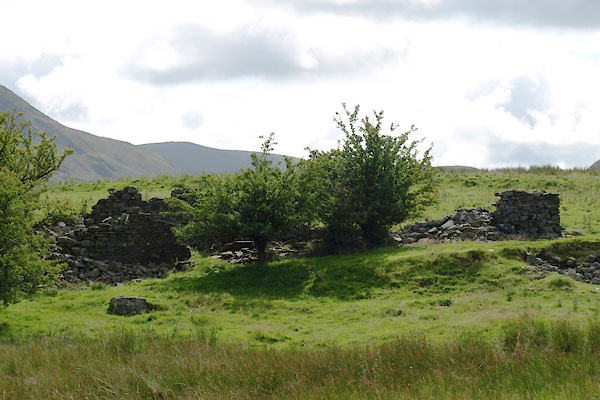 BVE99.jpg (taken 17.8.2011) |
||
|
|
||
| evidence:- | old map:- Donald 1774 (Cmd) placename:- Peal |
|
| source data:- | Map, hand coloured engraving, 3x2 sheets, The County of Cumberland, scale about 1
inch to 1 mile, by Thomas Donald, engraved and published by Joseph Hodskinson, 29
Arundel Street, Strand, London, 1774.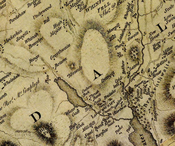 D4NY12SW.jpg "Peal" no symbol item:- Carlisle Library : Map 2 Image © Carlisle Library |
|
|
|
||
| evidence:- | old map:- Crosthwaite 1783-94 (But/Cru/Low) placename:- Peel |
|
| source data:- | Map, uncoloured engraving, An Accurate Map of Buttermere,
Crummock and Loweswater Lakes, scale about 3 inches to 1 mile,
by Peter Crosthwaite, Keswick, Cumberland, 1794, version
published 1800.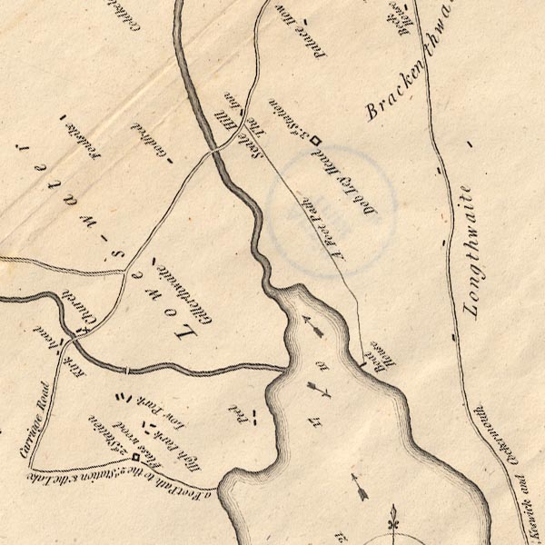 CT8NY12K.jpg "Peel" item:- Armitt Library : 1959.191.2 Image © see bottom of page |
|
|
|
||
| notes:- |
remains of a supposed tower |
|
| Perriam, D R &Robinson, J: 1998: Medieval Fortified Buildings of Cumbria: CWAAS::
ISBN 1 873124 23 6 |
||
|
|
||
 Lakes Guides menu.