 Old Cumbria Gazetteer
 |
 |
|
| Pedge Croft, Sedbergh | ||
| Pedge Croft | ||
| locality:- | Sedbergh | |
| civil parish:- | Sedbergh (formerly Yorkshire) | |
| county:- | Cumbria | |
| locality type:- | buildings | |
| coordinates:- | SD66659215 | |
| 1Km square:- | SD6692 | |
| 10Km square:- | SD69 | |
|
|
||
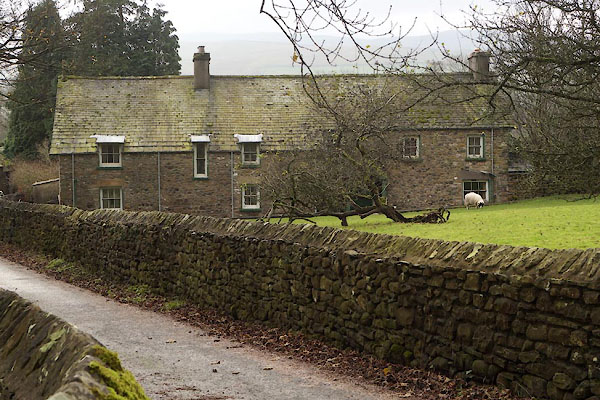 CCD55.jpg (taken 28.11.2014) 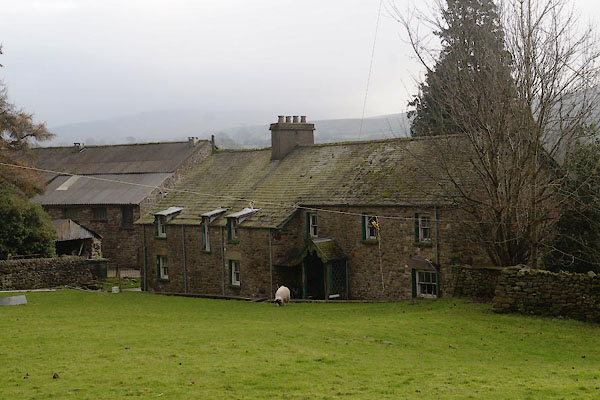 CCD56.jpg (taken 28.11.2014) |
||
|
|
||
| evidence:- | old map:- OS County Series (Yrk 63 4) placename:- Pedge Croft |
|
| source data:- | Maps, County Series maps of Great Britain, scales 6 and 25
inches to 1 mile, published by the Ordnance Survey, Southampton,
Hampshire, from about 1863 to 1948. |
|
|
|
||
| evidence:- | database:- Listed Buildings 2010 placename:- Pedge Croft Farm |
|
| source data:- | courtesy of English Heritage "PEDGE CROFT FARMHOUSE / / LONG LANE / SEDBERGH / SOUTH LAKELAND / CUMBRIA / II / 484607 / SD6665292158" |
|
|
|
||
 Lakes Guides menu.