Old Cumbria Gazetteer
 |
 |
|
||
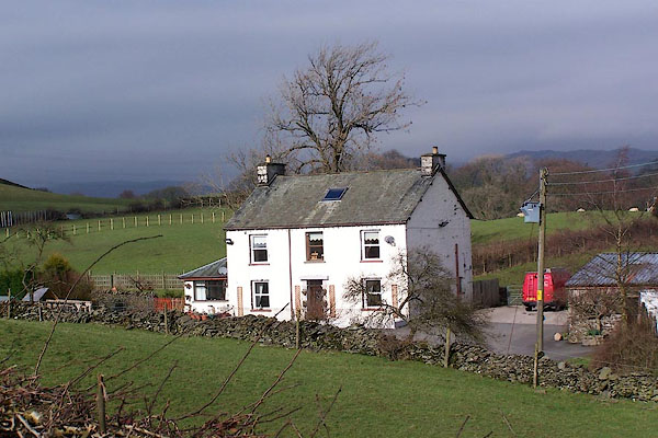
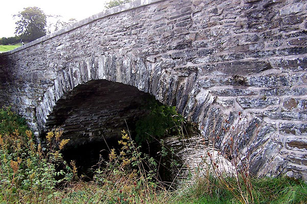
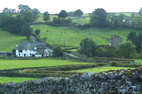
| Patton Bridge, Whinfell | ||||
| Patton Bridge | ||||
| civil parish:- | Whinfell (formerly Westmorland) | |||
| county:- | Cumbria | |||
| locality type:- | locality | |||
| locality type:- | buildings | |||
| coordinates:- | SD55739738 (etc) | |||
| 1Km square:- | SD5597 | |||
| 10Km square:- | SD59 | |||
|
|
||||
 BJW72.jpg (taken 29.9.2005) |
||||
|
|
||||
| evidence:- | old map:- Jansson 1646 |
|||
| source data:- | Map, hand coloured engraving, Cumbria and Westmoria, ie
Cumberland and Westmorland, scale about 3.5 miles to 1 inch, by
John Jansson, Amsterdam, Netherlands, 1646.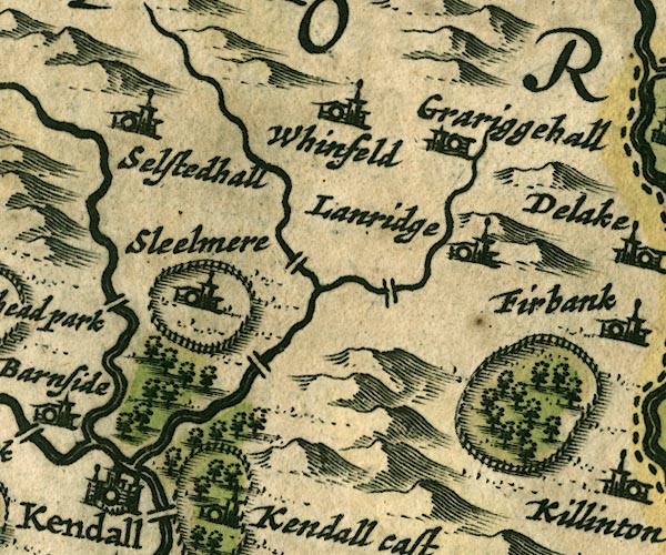 JAN3SD59.jpg Double line crossing the stream. item:- JandMN : 88 Image © see bottom of page |
|||
|
|
||||
| evidence:- | hearth tax returns:- Hearth Tax 1675 placename:- Pattonfolds |
|||
| source data:- | Records, hearth tax survey returns, Westmorland, 1674/75. "Pattonfolds" in "Whitfell and selside" |
|||
|
|
||||
| evidence:- | roughly old map:- Ford 1839 map placename:- Patton |
|||
| source data:- | Map, uncoloured engraving, Map of the Lake District of
Cumberland, Westmoreland and Lancashire, scale about 3.5 miles
to 1 inch, published by Charles Thurnam, Carlisle, and by R
Groombridge, 5 Paternoster Row, London, 3rd edn 1843.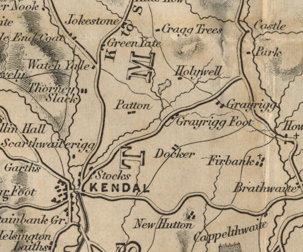 FD02SD59.jpg "Patton" item:- JandMN : 100.1 Image © see bottom of page |
|||
|
|
||||
| places:- |
|
|||
|
||||
|
||||
|
||||
|
||||
 Lakes Guides menu.