 Old Cumbria Gazetteer
 |
 |
|
| Park Side, Above Derwent | ||
| Park Side | ||
| civil parish:- | Above Derwent (formerly Cumberland) | |
| county:- | Cumbria | |
| locality type:- | buildings | |
| coordinates:- | NY24752181 (estimate) | |
| 1Km square:- | NY2421 | |
| 10Km square:- | NY22 | |
| SummaryText:- | cf The Park. | |
| references:- | Crosthwaite 1783-94 |
|
|
|
||
| evidence:- | old map:- OS County Series (Cmd 64 9) placename:- Parkside |
|
| source data:- | Maps, County Series maps of Great Britain, scales 6 and 25
inches to 1 mile, published by the Ordnance Survey, Southampton,
Hampshire, from about 1863 to 1948. |
|
|
|
||
| evidence:- | old map:- Crosthwaite 1783-94 (Der) placename:- Park Side |
|
| source data:- | Map, uncoloured engraving, An Accurate Map of the Matchless Lake
of Derwent, ie Derwent Water, scale about 3 inches to 1 mile, by
Peter Crosthwaite, Keswick, Cumberland, 1783, version published
1800.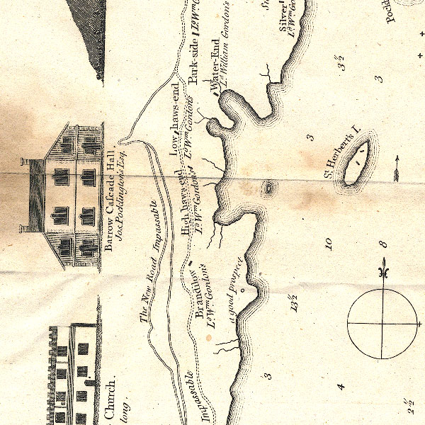 CT2NY21P.jpg "Park-side / Ld. Wm. Gordon's" item:- Armitt Library : 1959.191.3 Image © see bottom of page |
|
|
|
||
 Lakes Guides menu.