 Old Cumbria Gazetteer
 |
 |
|
| Park Bridge, Loweswater | ||
| Park Bridge | ||
| site name:- | Park Beck (2) | |
| locality:- | Parks | |
| locality:- | Loweswater | |
| civil parish:- | Loweswater (formerly Cumberland) | |
| county:- | Cumbria | |
| locality type:- | bridge | |
| coordinates:- | NY14452051 | |
| 1Km square:- | NY1420 | |
| 10Km square:- | NY12 | |
|
|
||
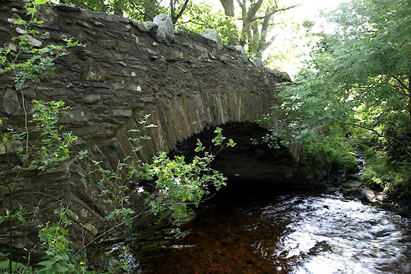 BVE95.jpg 17.8.2011 |
||
|
|
||
| evidence:- | old map:- Donald 1774 (Cmd) |
|
| source data:- | Map, hand coloured engraving, 3x2 sheets, The County of Cumberland, scale about 1
inch to 1 mile, by Thomas Donald, engraved and published by Joseph Hodskinson, 29
Arundel Street, Strand, London, 1774.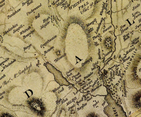 D4NY12SW.jpg double line across a river; a bridge over beck from Loweswater item:- Carlisle Library : Map 2 Image © Carlisle Library |
|
|
|
||
| evidence:- | old map:- Crosthwaite 1783-94 (But/Cru/Low) |
|
| source data:- | Map, uncoloured engraving, An Accurate Map of Buttermere,
Crummock and Loweswater Lakes, scale about 3 inches to 1 mile,
by Peter Crosthwaite, Keswick, Cumberland, 1794, version
published 1800.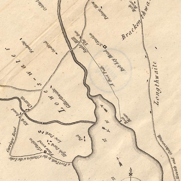 CT8NY12K.jpg drawn by a double line across the stream. item:- Armitt Library : 1959.191.2 Image © see bottom of page |
|
|
|
||
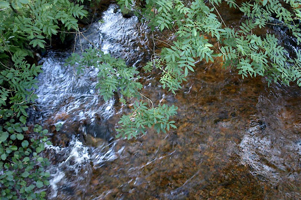 BVE96.jpg View of river. (taken 17.8.2011) |
||
|
|
||
 Lakes Guides menu.