 Old Cumbria Gazetteer
 |
 |
|
| Palacehow, Buttermere | ||
| Palacehow | ||
| locality:- | Brackenthwaite | |
| civil parish:- | Buttermere (formerly Cumberland) | |
| county:- | Cumbria | |
| locality type:- | buildings | |
| coordinates:- | NY15242201 | |
| 1Km square:- | NY1522 | |
| 10Km square:- | NY12 | |
|
|
||
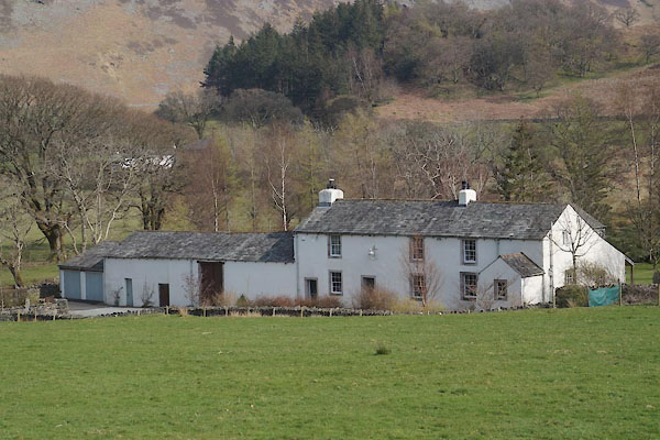 CCU39.jpg (taken 10.4.2015) |
||
|
|
||
| evidence:- | old map:- OS County Series (Cmd 63 9) placename:- Palace How |
|
| source data:- | Maps, County Series maps of Great Britain, scales 6 and 25
inches to 1 mile, published by the Ordnance Survey, Southampton,
Hampshire, from about 1863 to 1948. |
|
|
|
||
| evidence:- | old map:- Crosthwaite 1783-94 (But/Cru/Low) placename:- Palace How |
|
| source data:- | Map, uncoloured engraving, An Accurate Map of Buttermere,
Crummock and Loweswater Lakes, scale about 3 inches to 1 mile,
by Peter Crosthwaite, Keswick, Cumberland, 1794, version
published 1800.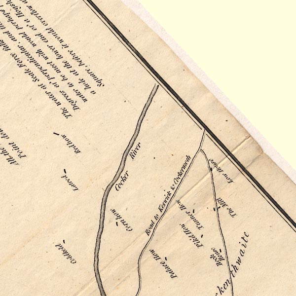 CT8NY12L.jpg "Palace How" item:- Armitt Library : 1959.191.2 Image © see bottom of page |
|
|
|
||
| evidence:- | database:- Listed Buildings 2010 placename:- Palace How |
|
| source data:- | courtesy of English Heritage "PALACE HOW / / / BUTTERMERE / ALLERDALE / CUMBRIA / II / 72161 / NY1524822015" |
|
|
|
||
 Lakes Guides menu.