 Old Cumbria Gazetteer
 |
 |
|
| Otter Bank, Skelsmergh | ||
| Otter Bank | ||
| civil parish:- | Skelsmergh (formerly Westmorland) | |
| county:- | Cumbria | |
| locality type:- | buildings | |
| coordinates:- | SD53179715 | |
| 1Km square:- | SD5397 | |
| 10Km square:- | SD59 | |
|
|
||
| evidence:- | old map:- OS County Series (Wmd 34 9) placename:- Otter Bank |
|
| source data:- | Maps, County Series maps of Great Britain, scales 6 and 25
inches to 1 mile, published by the Ordnance Survey, Southampton,
Hampshire, from about 1863 to 1948. |
|
|
|
||
| evidence:- | old map:- Jefferys 1770 (Wmd) placename:- Hutter Bank |
|
| source data:- | Map, 4 sheets, The County of Westmoreland, scale 1 inch to 1
mile, surveyed 1768, and engraved and published by Thomas
Jefferys, London, 1770.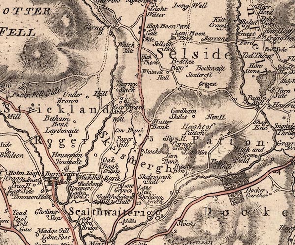 J5SD59NW.jpg "Hutter Bank" circle, labelled in italic lowercase text; settlement, farm, house, or hamlet? item:- National Library of Scotland : EME.s.47 Image © National Library of Scotland |
|
|
|
||
| evidence:- | old map:- Cary 1789 (edn 1805) placename:- Hutter Bank |
|
| source data:- | Map, uncoloured engraving, Westmoreland, scale about 2.5 miles
to 1 inch, by John Cary, London, 1789; edition 1805.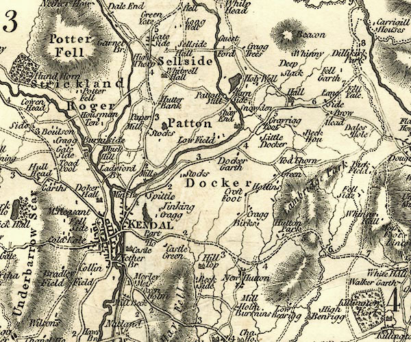 CY24SD59.jpg "Hutter Bank" block/s, labelled in italic lowercase; house, or hamlet item:- JandMN : 129 Image © see bottom of page |
|
|
|
||
| evidence:- | probably old map:- Laurie and Whittle 1806 placename:- Hutter Bank |
|
| source data:- | Road map, Completion of the Roads to the Lakes, scale about 10
miles to 1 inch, by Nathaniel Coltman? 1806, published by Robert
H Laurie, 53 Fleet Street, London, 1834. click to enlarge click to enlargeLw18.jpg "Hutter Bank 265" village or other place; distance from London item:- private collection : 18.18 Image © see bottom of page |
|
|
|
||
 Lakes Guides menu.