 Old Cumbria Gazetteer
 |
 |
|
| Orthwaite Hall, Orthwaite | ||
| Orthwaite Hall | ||
| locality:- | Orthwaite | |
| civil parish:- | Ireby (formerly Cumberland) | |
| county:- | Cumbria | |
| locality type:- | buildings | |
| coordinates:- | NY25263418 | |
| 1Km square:- | NY2534 | |
| 10Km square:- | NY23 | |
|
|
||
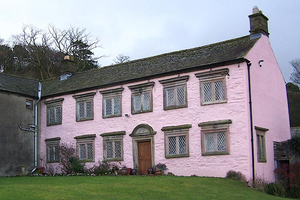 BOJ49.jpg (taken 29.11.2007) 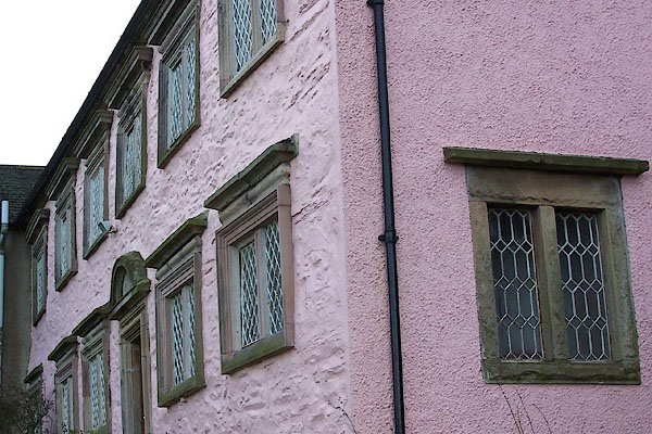 BOJ50.jpg (taken 29.11.2007) |
||
|
|
||
| evidence:- | old map:- OS County Series (Cmd 47 9) placename:- Orthwaite Hall |
|
| source data:- | Maps, County Series maps of Great Britain, scales 6 and 25
inches to 1 mile, published by the Ordnance Survey, Southampton,
Hampshire, from about 1863 to 1948. |
|
|
|
||
| evidence:- | probably old map:- Gents Mag 1751 placename:- Orthwaite |
|
| source data:- | Map, uncoloured engraving, Map of the Black Lead Mines in
Cumberland, and area, scale about 2 miles to 1 inch, by George
Smith, published in the Gentleman's Magazine, 1751.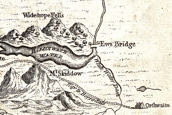 GM1313.jpg "Orthwaite" house item:- JandMN : 114 Image © see bottom of page |
|
|
|
||
| evidence:- | old map:- Donald 1774 (Cmd) |
|
| source data:- | Map, hand coloured engraving, 3x2 sheets, The County of Cumberland, scale about 1
inch to 1 mile, by Thomas Donald, engraved and published by Joseph Hodskinson, 29
Arundel Street, Strand, London, 1774.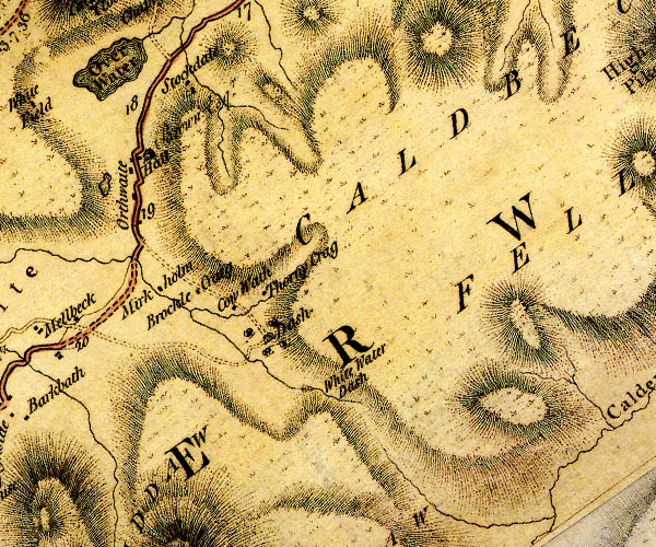 D4NY23SE.jpg "Hall / Brown Esqr." house at Orthwaite item:- Carlisle Library : Map 2 Image © Carlisle Library |
|
|
|
||
| evidence:- | probably old map:- Ford 1839 map |
|
| source data:- | Map, uncoloured engraving, Map of the Lake District of
Cumberland, Westmoreland and Lancashire, scale about 3.5 miles
to 1 inch, published by Charles Thurnam, Carlisle, and by R
Groombridge, 5 Paternoster Row, London, 3rd edn 1843.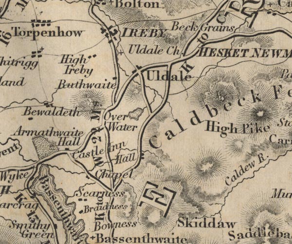 FD02NY23.jpg "Hall" item:- JandMN : 100.1 Image © see bottom of page |
|
|
|
||
| evidence:- | old map:- Garnett 1850s-60s H placename:- Orthwaite Hall |
|
| source data:- | Map of the English Lakes, in Cumberland, Westmorland and
Lancashire, scale about 3.5 miles to 1 inch, published by John
Garnett, Windermere, Westmorland, 1850s-60s.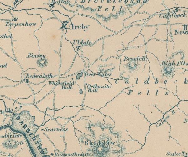 GAR2NY23.jpg "Orthwaite Hall" block, building item:- JandMN : 82.1 Image © see bottom of page |
|
|
|
||
| evidence:- | database:- Listed Buildings 2010 placename:- Orthwaite Hall item:- coat of arms; date stone (1675) |
|
| source data:- | courtesy of English Heritage "ORTHWAITE HALL AND ADJOINING BARN / / / IREBY AND ULDALE / ALLERDALE / CUMBRIA / II[star] / 72434 / NY2527234183" |
|
|
|
||
| hearsay:- |
William George Brown, traveller in the middle east lived here; he was murdered in
Persia, 1812. |
|
|
|
||
 Lakes Guides menu.