 Old Cumbria Gazetteer
 |
 |
|
| Netherhirst, Solport | ||
| Netherhirst | ||
| civil parish:- | Solport (formerly Cumberland) | |
| county:- | Cumbria | |
| locality type:- | buildings | |
| coordinates:- | NY44887322 | |
| 1Km square:- | NY4473 | |
| 10Km square:- | NY47 | |
|
|
||
| evidence:- | old map:- Ogilby 1675 (plate 62) placename:- Nether Hurst |
|
| source data:- | Raod strip map, uncoloured engraving, the Road from Carlisle to
Barwick, scale about 1 inch to 1 mile, by John Ogilby, London,
1675.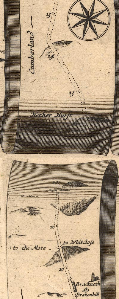 OG62m010.jpg In mile 12, Cumberland. "Nether Hurst" labelled left of the road. item:- JandMN : 83 Image © see bottom of page |
|
|
|
||
| evidence:- | old map:- Bowen 1720 (plate 161) placename:- Nether Hurst |
|
| source data:- | Road strip map, uncoloured engraving, pl.161, part of The Road
from Carlisle to Barwick, scale about 2 miles to 1 inch, with
sections in Cumberland, and Scotland, published by Emanuel
Bowen, St Katherines, London, 1720.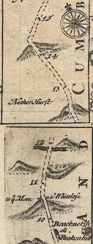 B161m10.jpg "Nether Hurst" Not located on the map; about mile 13. item:- JandMN : 65.161 Image © see bottom of page |
|
|
|
||
| evidence:- | old map:- Donald 1774 (Cmd) placename:- Nether Hirst placename:- Hirst, Nether |
|
| source data:- | Map, hand coloured engraving, 3x2 sheets, The County of Cumberland, scale about 1
inch to 1 mile, by Thomas Donald, engraved and published by Joseph Hodskinson, 29
Arundel Street, Strand, London, 1774. D4NY47SE.jpg "Nether hirst" block or blocks, labelled in lowercase; a hamlet or just a house item:- Carlisle Library : Map 2 Image © Carlisle Library |
|
|
|
||
 Lakes Guides menu.