 Old Cumbria Gazetteer
 |
 |
|
| Near Orrest, Windermere | ||
| Near Orrest | ||
| civil parish:- | Windermere (formerly Westmorland) | |
| county:- | Cumbria | |
| locality type:- | buildings | |
| coordinates:- | NY41870020 | |
| 1Km square:- | NY4100 | |
| 10Km square:- | NY40 | |
|
|
||
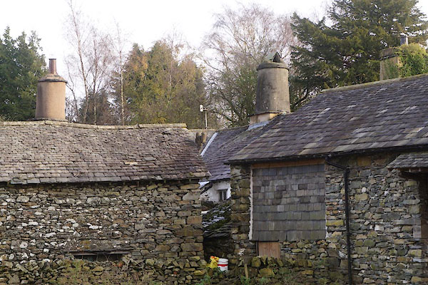 CFS03.jpg (taken 11.11.2016) |
||
|
|
||
| evidence:- | old map:- OS County Series (Wmd 32 4) placename:- Near Orrest placename:- Orrest, Near |
|
| source data:- | Maps, County Series maps of Great Britain, scales 6 and 25
inches to 1 mile, published by the Ordnance Survey, Southampton,
Hampshire, from about 1863 to 1948. |
|
|
|
||
| evidence:- | old map:- Jefferys 1770 (Wmd) placename:- Orest |
|
| source data:- | Map, 4 sheets, The County of Westmoreland, scale 1 inch to 1
mile, surveyed 1768, and engraved and published by Thomas
Jefferys, London, 1770.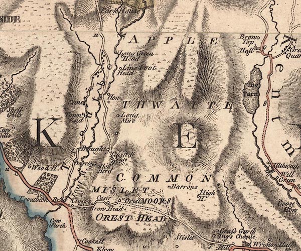 J5NY40SW.jpg "Orest" circle, labelled in italic lowercase text; settlement, farm, house, or hamlet? item:- National Library of Scotland : EME.s.47 Image © National Library of Scotland |
|
|
|
||
| evidence:- | database:- Listed Buildings 2010 placename:- Near Orrest Farm |
|
| source data:- | courtesy of English Heritage "NEAR ORREST FARMHOUSE / / / WINDERMERE TOWN / SOUTH LAKELAND / CUMBRIA / II[star] / 351652 / NY4187500202" |
|
|
|
||
 Lakes Guides menu.