 Old Cumbria Gazetteer
 |
 |
|
| Moors, Firbank | ||
| Moors | ||
| Moors Farm | ||
| civil parish:- | Firbank (formerly Westmorland) | |
| county:- | Cumbria | |
| locality type:- | buildings | |
| coordinates:- | SD61959532 | |
| 1Km square:- | SD6195 | |
| 10Km square:- | SD69 | |
|
|
||
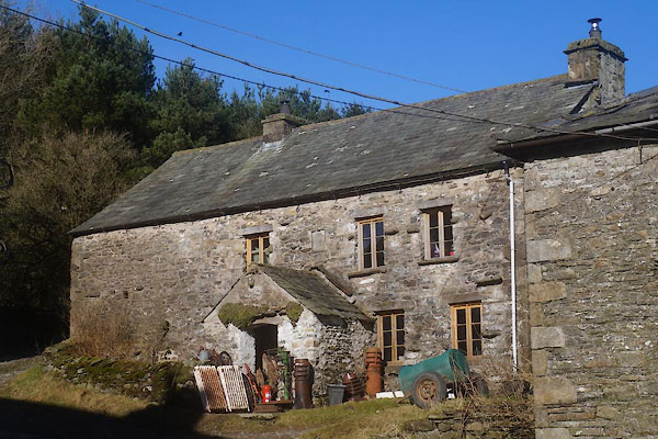 CEQ85.jpg (taken 7.3.2016) 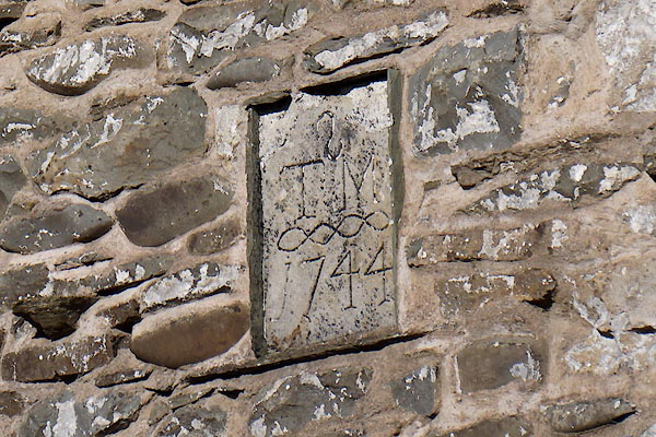 CEQ86.jpg Date stone:- "S / T M / 1744" (taken 7.3.2016) |
||
|
|
||
| evidence:- | old map:- OS County Series (Wmd 34 16) placename:- Moors |
|
| source data:- | Maps, County Series maps of Great Britain, scales 6 and 25
inches to 1 mile, published by the Ordnance Survey, Southampton,
Hampshire, from about 1863 to 1948. |
|
|
|
||
| evidence:- | old map:- Jefferys 1770 (Wmd) placename:- Moors |
|
| source data:- | Map, 4 sheets, The County of Westmoreland, scale 1 inch to 1
mile, surveyed 1768, and engraved and published by Thomas
Jefferys, London, 1770.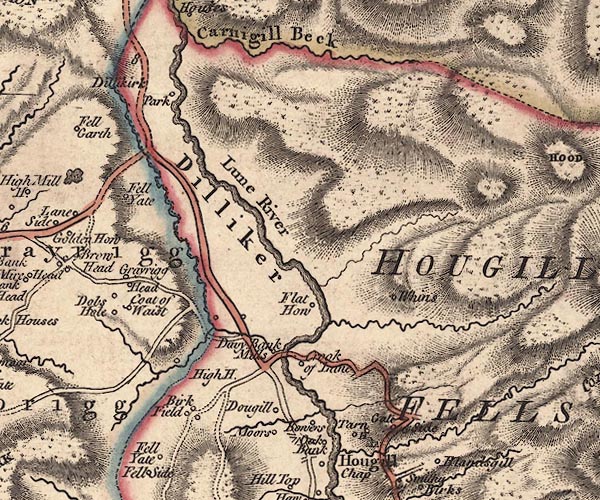 J5SD69NW.jpg "Moors" circle, labelled in italic lowercase text; settlement, farm, house, or hamlet? item:- National Library of Scotland : EME.s.47 Image © National Library of Scotland |
|
|
|
||
| evidence:- | database:- Listed Buildings 2010 item:- date stone (1744) |
|
| source data:- | courtesy of English Heritage "COTTAGE TO NORTH OF MOORS FARMHOUSE / / B6257 / FIRBANK / SOUTH LAKELAND / CUMBRIA / II / 75646 / SD6190995269" |
|
|
|
||
 Lakes Guides menu.