 Old Cumbria Gazetteer
 |
 |
|
| water trough, Rampside | ||
| Street:- | Roa Island Road | |
| locality:- | Rampside | |
| civil parish:- | Barrow-in-Furness (formerly Lancashire) | |
| county:- | Cumbria | |
| locality type:- | water trough | |
| coordinates:- | SD23906614 | |
| 1Km square:- | SD2366 | |
| 10Km square:- | SD26 | |
|
|
||
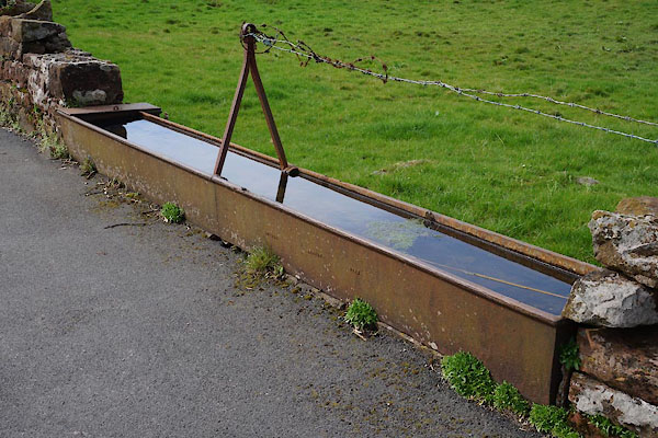 CAG31.jpg (taken 4.4.2014) 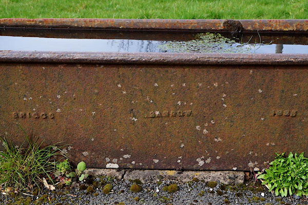 CAG32.jpg "[BRIGGS BARROW 18 ]" (taken 4.4.2014) |
||
| Perhaps Joseph Briggs, Marsh Foundry, about 1869? |
||
|
|
||
 Lakes Guides menu.