 Old Cumbria Gazetteer
 |
 |
|
| Milnthorpe Station, Milnthorpe | ||
| Milnthorpe Station | ||
| site name:- | Lancaster and Carlisle Railway | |
| locality:- | Milnthorpe | |
| civil parish:- | Milnthorpe (formerly Westmorland) | |
| county:- | Cumbria | |
| locality type:- | railway station | |
| coordinates:- | SD51268168 | |
| 1Km square:- | SD5181 | |
| 10Km square:- | SD58 | |
| SummaryText:- | Opened with the railway 1846; closed 1968. | |
|
|
||
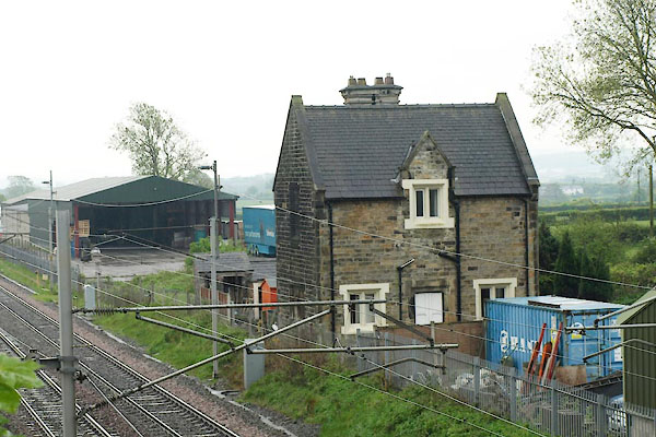 BUN05.jpg (taken 6.5.2011) 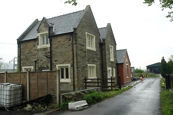 BUN04.jpg (taken 6.5.2011) |
||
|
|
||
| evidence:- | old map:- OS County Series (Wmd 46 4) placename:- Milnthorpe Station item:- railway signal |
|
| source data:- | Maps, County Series maps of Great Britain, scales 6 and 25
inches to 1 mile, published by the Ordnance Survey, Southampton,
Hampshire, from about 1863 to 1948.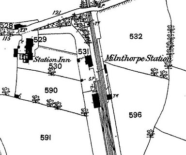 click to enlarge click to enlargeCSRY0169.jpg "Milnthorpe Station / S.P. / Station Inn / ..." |
|
|
|
||
| evidence:- | old map:- Garnett 1850s-60s H |
|
| source data:- | Map of the English Lakes, in Cumberland, Westmorland and
Lancashire, scale about 3.5 miles to 1 inch, published by John
Garnett, Windermere, Westmorland, 1850s-60s.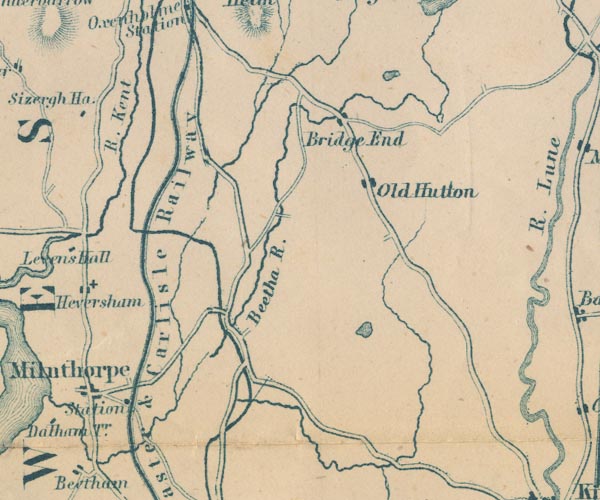 GAR2SD58.jpg "Station" dot by railway item:- JandMN : 82.1 Image © see bottom of page |
|
|
|
||
| evidence:- | probably old map:- Postlethwaite 1877 (3rd edn 1913) |
|
| source data:- | Map, uncoloured engraving, Map of the Lake District Mining Field, Westmorland, Cumberland,
Lancashire, scale about 5 miles to 1 inch, by John Postlethwaite, published by W H
Moss and Sons, 13 Lowther Street, Whitehaven, Cumberland, 1877 edn 1913. PST2SD58.jpg station on railway item:- JandMN : 162.2 Image © see bottom of page |
|
|
|
||
| evidence:- | old map:- LMS 1920s maps |
|
| source data:- | Railway map, lithograph, 23 pages of strip maps, The Journey in
Brief, the Route London to Carlisle, published by the London
Midland and Scottish Railway, LMS, 1920s.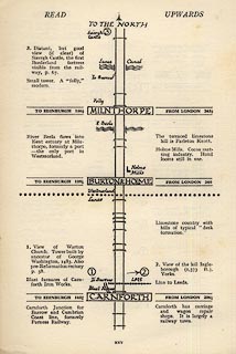 click to enlarge click to enlargeLS3p25.jpg "TO EDINBURGH 156½ / MILNTHORPE / FROM LONDON 243½" item:- JandMN : 95.2 Image © see bottom of page |
|
|
|
||
 Lakes Guides menu.