 Old Cumbria Gazetteer
 |
 |
|
| Millwood, Barrow-in-Furness | ||
| Millwood | ||
| civil parish:- | Barrow-in-Furness (formerly Lancashire) | |
| county:- | Cumbria | |
| locality type:- | buildings | |
| coordinates:- | SD21817303 | |
| 1Km square:- | SD2173 | |
| 10Km square:- | SD27 | |
|
|
||
| evidence:- | old map:- Ford 1839 map placename:- Mill Wood |
|
| source data:- | Map, uncoloured engraving, Map of the Lake District of
Cumberland, Westmoreland and Lancashire, scale about 3.5 miles
to 1 inch, published by Charles Thurnam, Carlisle, and by R
Groombridge, 5 Paternoster Row, London, 3rd edn 1843.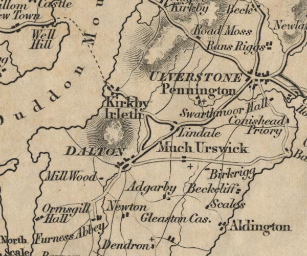 FD02SD27.jpg "Mill Wood" item:- JandMN : 100.1 Image © see bottom of page |
|
|
|
||
| evidence:- | database:- Listed Buildings 2010 placename:- Millwood |
|
| source data:- | courtesy of English Heritage "MILLWOOD / / MILLWOOD LANE / BARROW IN FURNESS / BARROW IN FURNESS / CUMBRIA / II / 388537 / SD2181273038" |
|
|
|
||
 Lakes Guides menu.