 Old Cumbria Gazetteer
 |
 |
|
| milestone, Brough (2) | ||
| site name:- | road, Brough to Middleton-in-Teesdale | |
| locality:- | Brough | |
| civil parish:- | Brough (formerly Westmorland) | |
| county:- | Cumbria | |
| locality type:- | milestone | |
| coordinates:- | NY79911466 | |
| 1Km square:- | NY7914 | |
| 10Km square:- | NY71 | |
|
|
||
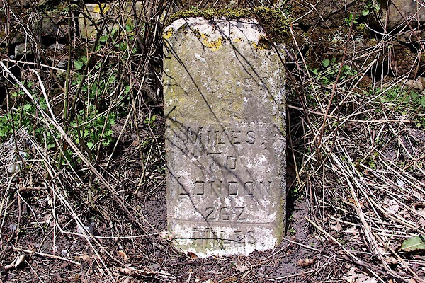 BLX28.jpg Inscribed stone, partly defaced:- "[ O ES 13 ] MILES TO LONDON 262 MILES" (taken 21.4.2006) |
||
| The 2 at the end looks as if it could be an alteration? |
||
|
|
||
| evidence:- | old map:- OS County Series (Wmd 16 16) placename:- |
|
| source data:- | Maps, County Series maps of Great Britain, scales 6 and 25
inches to 1 mile, published by the Ordnance Survey, Southampton,
Hampshire, from about 1863 to 1948. "Bowes .. 13 London .. 260 M.S." |
|
|
|
||
| evidence:- | old map:- Jefferys 1770 (Wmd) |
|
| source data:- | Map, 4 sheets, The County of Westmoreland, scale 1 inch to 1
mile, surveyed 1768, and engraved and published by Thomas
Jefferys, London, 1770.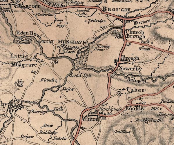 J5NY71SE.jpg "28" milestone marked by road item:- National Library of Scotland : EME.s.47 Image © National Library of Scotland |
|
|
|
||
| evidence:- | database:- Listed Buildings 2010 |
|
| source data:- | courtesy of English Heritage "MILESTONE TO SOUTH-EAST OF SWINDALE COTTAGES / / B6276 (NORTH EAST OF BROUGH; NORTH SIDE) / BROUGH / EDEN / CUMBRIA / II / 73292 / NY7991514665" |
|
| source data:- | courtesy of English Heritage "Milestone; C19. Single stone with elliptical top and edge chamfers. Inscription damaged to top; sans serif: BOWES 13 MILES TO LONDON 262 MILES." |
|
|
|
||
 Lakes Guides menu.