 Old Cumbria Gazetteer
 |
 |
|
| milestone, Ravenstonedale (2) | ||
| site name:- | road, Sedbergh to Kirkby Stephen | |
| civil parish:- | Ravenstonedale (formerly Westmorland) | |
| county:- | Cumbria | |
| locality type:- | milestone | |
| coordinates:- | NY74940341 | |
| 1Km square:- | NY7403 | |
| 10Km square:- | NY70 | |
|
|
||
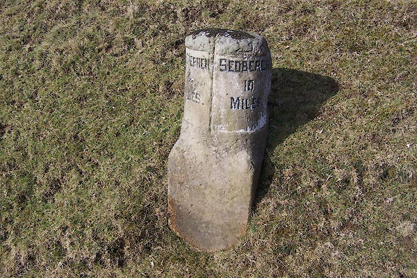 BLQ31.jpg Inscribed stone:- "KY. STEPHEN 4 MILES / SEDBERGH 10 MILES" (taken 25.2.2005) |
||
|
|
||
| evidence:- | old map:- OS County Series (Wmd 30 10) |
|
| source data:- | Maps, County Series maps of Great Britain, scales 6 and 25
inches to 1 mile, published by the Ordnance Survey, Southampton,
Hampshire, from about 1863 to 1948. "Kirkby Stephen .. 4 sedbergh .. 10 M.S." |
|
|
|
||
| evidence:- | database:- Listed Buildings 2010 |
|
| source data:- | courtesy of English Heritage "MILESTONE OPPOSITE TARN HOUSE (AT NGR NY 749 034) / / A683 / RAVENSTONEDALE / EDEN / CUMBRIA / II / 74102 / NY7490003400" |
|
| source data:- | courtesy of English Heritage "Milestone. Probably c1822 when road was re-aligned; for Sedbergh Turnpike Trust. Single stone c.2 1/2 ft high. Base square in plan with front of upper section rounded. Incised sans-serif lettering: East face SEDBERGH 10 MILES; West face KY STEPHEN 4 MILES." |
|
|
|
||
 Lakes Guides menu.