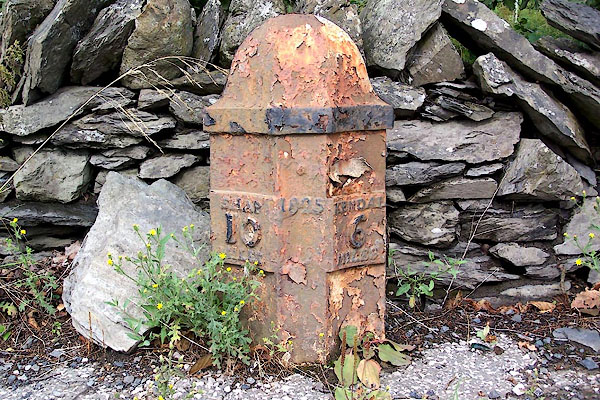


BJT42.jpg Cast iron:-
"SHAP 10 MILES / 1825 / KENDAL 6 MILES" (taken 22.8.2005)
"M.S Shap .. 10 Kendal .. 6"
courtesy of English Heritage
"MILEPOST OPPOSITE MEMORIAL HALL / / A6 / WHITWELL AND SELSIDE / SOUTH LAKELAND / CUMBRIA / II / 75765 / NY5403500564"
courtesy of English Heritage
"Milepost. Dated 1825. Cast iron. Half-hexagonal with concave faces and domed cap. Lettering on panels to sides reading: "SHAP/l0/MILES"; to right: "KENDAL/6/MILES"; date to centre. One of a series of mileposts on Heron Syke to Eamont Bridge turnpike road, 1753."

 Lakes Guides menu.