 Old Cumbria Gazetteer
 |
 |
|
| Middleshaw, Old Hutton and Holmescales | ||
| Middleshaw | ||
| civil parish:- | Old Hutton and Holmescales (formerly Westmorland) | |
| county:- | Cumbria | |
| locality type:- | buildings | |
| coordinates:- | SD55648914 | |
| 1Km square:- | SD5589 | |
| 10Km square:- | SD58 | |
|
|
||
| evidence:- | old map:- OS County Series (Wmd 39 14) placename:- Middleshaw |
|
| source data:- | Maps, County Series maps of Great Britain, scales 6 and 25
inches to 1 mile, published by the Ordnance Survey, Southampton,
Hampshire, from about 1863 to 1948. |
|
|
|
||
| evidence:- | old map:- Jefferys 1770 (Wmd) |
|
| source data:- | Map, 4 sheets, The County of Westmoreland, scale 1 inch to 1
mile, surveyed 1768, and engraved and published by Thomas
Jefferys, London, 1770.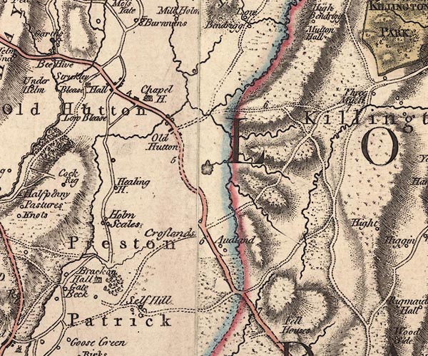 J5SD58NE.jpg blocks item:- National Library of Scotland : EME.s.47 Image © National Library of Scotland |
|
|
|
||
| evidence:- | possibly old map:- Garnett 1850s-60s H placename:- Bridge End |
|
| source data:- | Map of the English Lakes, in Cumberland, Westmorland and
Lancashire, scale about 3.5 miles to 1 inch, published by John
Garnett, Windermere, Westmorland, 1850s-60s.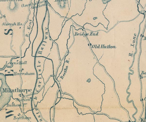 GAR2SD58.jpg "Bridge End" blocks, settlement item:- JandMN : 82.1 Image © see bottom of page |
|
|
|
||
 Lakes Guides menu.