 Old Cumbria Gazetteer
 |
 |
|
| Middale, Longsleddale | ||
| Middale | ||
| civil parish:- | Longsleddale (formerly Westmorland) | |
| county:- | Cumbria | |
| locality type:- | buildings | |
| coordinates:- | NY49600344 | |
| 1Km square:- | NY4903 | |
| 10Km square:- | NY40 | |
|
|
||
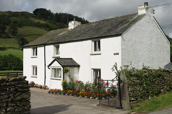 BRH98.jpg Flowers. (taken 27.8.2009) |
||
|
|
||
| evidence:- | old map:- OS County Series (Wmd 27 11) placename:- Middale |
|
| source data:- | Maps, County Series maps of Great Britain, scales 6 and 25
inches to 1 mile, published by the Ordnance Survey, Southampton,
Hampshire, from about 1863 to 1948.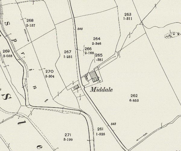 C5E013.jpg "Middale" |
|
|
|
||
| evidence:- | census returns:- placename:- Middale |
|
|
|
||
 old parish register (formerly ) old parish register (formerly ) |
||
|
|
||
| evidence:- | old map:- Hodgson 1828 placename:- Mid Dale |
|
| source data:- | Map, hand coloured engraving, 4 sheets mounted together on linen and rolled, Plan
of the County of Westmorland, scale about 1.25 inches to 1 mile, by Thomas Hodgson,
engraved by W R Gardner, Harpur Street, London, published by Thomas Hodgson, Lancaster,
and perhaps by C Smith, 172 Strand, London,1828.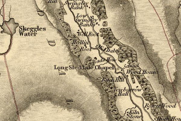 HDG6lsl2.jpg map courtesy of Mark Cropper "Mid Dale" item:- private collection : 371 Image © see bottom of page |
|
|
|
||
| evidence:- | old map:- Kendal Corn Rent Act 1836 placename:- Mid Dale |
|
| source data:- | Tithe map, Plan of part of the Township of Longsleddale, Westmorland, made regarding
the Kendal Corn Rent Act, ie a tithe award map, scale about 20 inches to 1 mile, Kendal,
Westmorland, 1836.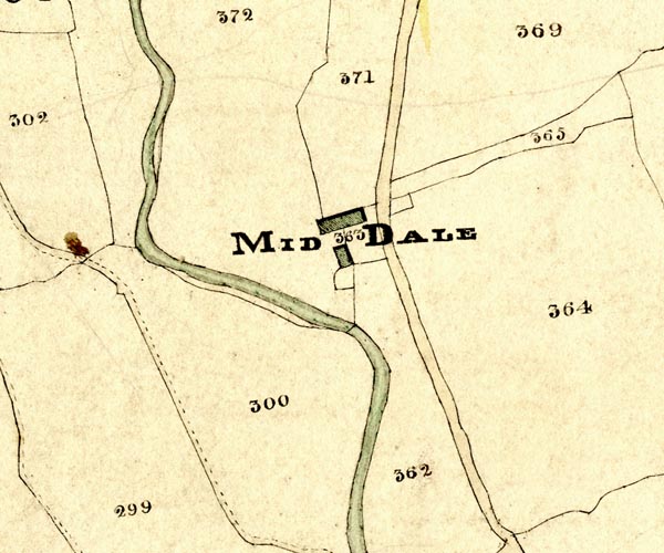 KCR213.jpg courtesy of Mark Cropper Plan of part of the Township of Longsleddale, Westmorland, made regarding the Kendal Corn Rent Act, ie a tithe award map, scale about 20 inches to 1 mile, Kendal, Westmorland, 1836. "MID DALE" item:- private collection : 370 Image © see bottom of page |
|
|
|
||
| Kendal Corn Rent Act 1836 |
||
|
|
||
| evidence:- | old map:- OS 1881-82 New Series (outline edition) placename:- Middale |
|
| source data:- | Map, engraving, area north of Kendal, Westmorland, New Series
one inch map, outline edition, sheet 39, scale 1 inch to 1 mile,
published by the Ordnance Survey, Southampton, Hampshire,
1881-82.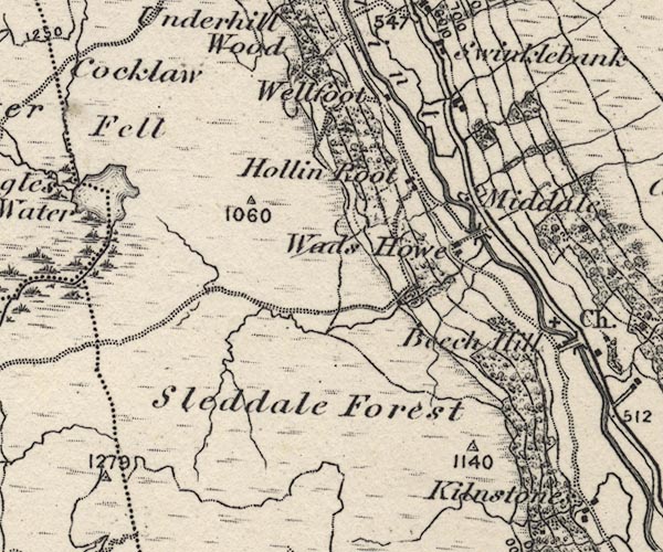 O21NY40W.jpg "Middale" item:- JandMN : 61 Image © see bottom of page |
|
|
|
||
| evidence:- | old postcard:- |
|
| source data:- | Postcard using a sepia toned photograph of people at Middale, Longsleddale alongside
a Christmas Greeting, dated 1907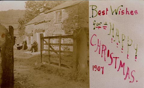 click to enlarge click to enlargePH0054.jpg courtesy of the Morton Family item:- private collection : 214 Image © see bottom of page |
|
|
|
||
| census records |
||
|
|
||
| directory entries |
||
|
|
||
| evidence:- | map:- OS Six Inch (1956) placename:- Middale |
|
| source data:- | Map series, various editions with the national grid, scale about
6 inches to 1 mile, published by the Ordnance Survey,
Southampton, Hampshire, scale 1 to 10560 from 1950s to 1960s,
then 1 to 10000 from 1960s to 2000s, superseded by print on
demand from digital data.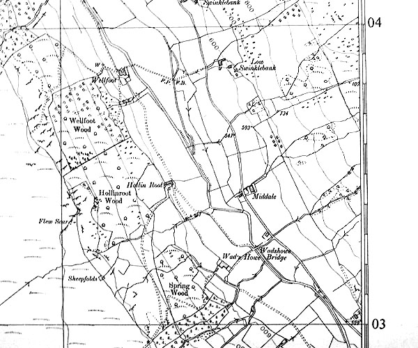 SINY4903.jpg "Middale" |
|
|
|
||
| evidence:- | shepherds guide:- Wilson 1913 placename:- Middale |
|
| source data:- | Book, New Shepherd's Guide for Cumberland, Westmorland, and
Lancashire, by Thomas Wilson, 1913.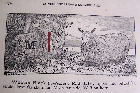 WL1p370a.jpg "William Black ..., Mid-dale; upper fold bitted far, stroke down far shoulder, M on far side, W B on horn." item:- private collection : 329 Image © see bottom of page |
|
|
|
||
| evidence:- | shepherds guide:- Gate 1879 placename:- Mid Dale |
|
| source data:- | Book, New Shepherd's Guide for Cumberland, Westmoreland, and
Lancashire, published by Daniel Gate, Keswick, Cumberland, 1879.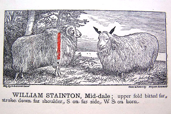 GT1p386c.jpg "WILLIAM STAINTON, Mid-dale; upper fold bitted far, stroke down far shoulder, S on far side, WS on horn." item:- Kendal Library : 38 Image © see bottom of page |
|
|
|
||
| evidence:- | shepherds guide:- Hodgson 1849 placename:- Middale |
|
| source data:- | Book, Shepherd's Guide, or a Delineation of the Wool and Ear
Marks of the Different Stocks of Sheep, Lancashire, Cumberland,
and Westmorland, by William Hodgson, Normoss, Corney,
Cumberland, 1849.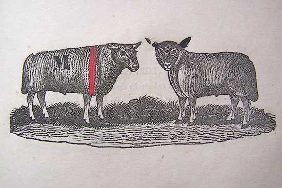 HG2p593b.jpg "JOHN MATTINSON, Middale." "Upper fold bitted far ear, a red stroke down the far shoulder, M on the far side, IM on the horn, and a figure." item:- Kendal Library : 39 Image © see bottom of page |
|
|
|
||
| evidence:- | shepherds guide:- Lamb 1937 placename:- Mid-dale |
|
| source data:- | Book, Lamb's Shepherds' Guide for Cumberland, Westmorland and
Lancashire, by R H Lamb, published by the Herald Printing Co,
Penrith, Cumberland, 1937.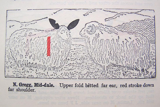 LM1p318c.jpg "N. Gregg, Mid-dale. Upper fold bitted far ear, red stroke down far shoulder." item:- Kendal Library : 40 Image © see bottom of page |
|
|
|
||
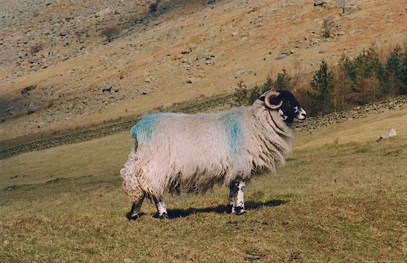 BIM36.jpg Swaledale sheep with the Middale mark, in the pasture below Galeforth Brow:- Blue stroke down farside shoulder. (taken 1.3.2004) 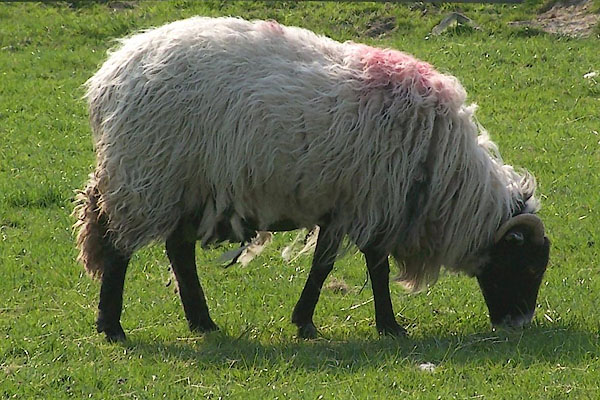 BMC84.jpg Sheep with the Wadshowe flock mark, in the pasture by Middale. Red pop on shoulder. (taken 12.5.2006) |
||
|
|
||
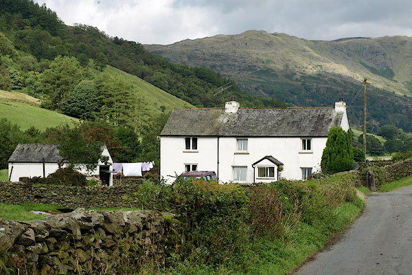 BRH97.jpg (taken 27.8.2009) 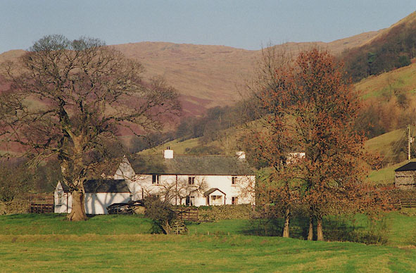 BIG26.jpg (taken 4.12.2003) 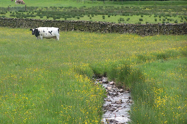 BNU73.jpg Cow and buttercups. (taken 7.6.2007) 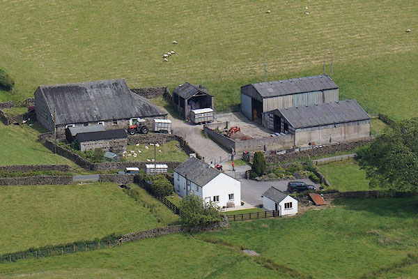 CBC46.jpg (taken 11.7.2014) 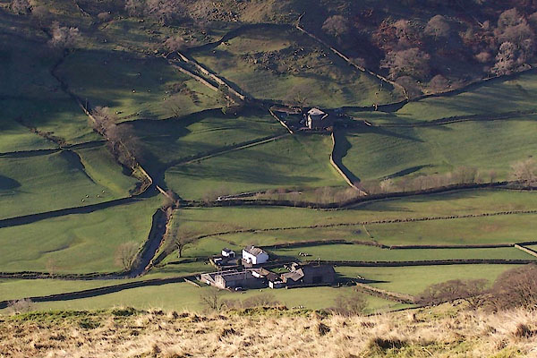 BXS59.jpg (taken 29.11.2012) |
||
|
|
||
 Lakes Guides menu.