 Old Cumbria Gazetteer
 |
 |
|
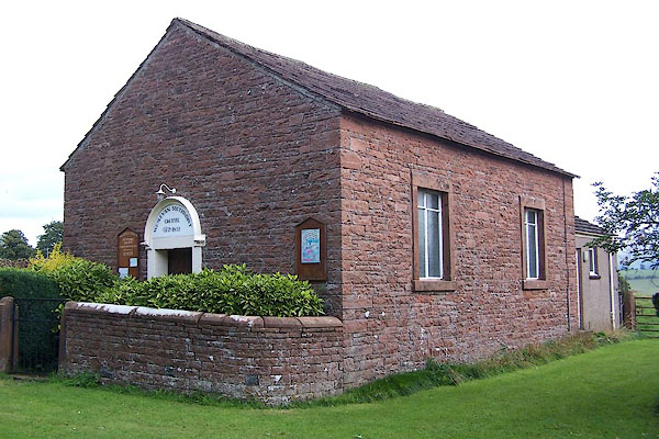
| chapel, Salkeld Dykes | ||
| Salkeld Dykes Chapel | ||
| locality:- | Salkeld Dykes | |
| civil parish:- | Great Salkeld (formerly Cumberland) | |
| county:- | Cumbria | |
| locality type:- | methodist chapel | |
| locality type:- | chapel | |
| coordinates:- | NY54563650 | |
| 1Km square:- | NY5436 | |
| 10Km square:- | NY53 | |
|
|
||
 BJT97.jpg (taken 26.8.2005) 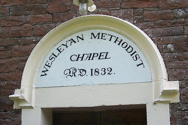 BJT98.jpg (taken 26.8.2005) |
||
|
|
||
| evidence:- | old map:- OS County Series (Cmd 50 2) |
|
| source data:- | Maps, County Series maps of Great Britain, scales 6 and 25
inches to 1 mile, published by the Ordnance Survey, Southampton,
Hampshire, from about 1863 to 1948. "Methodist Chapel (Wesleyan)" |
|
|
|
||
 Lakes Guides menu.