 Old Cumbria Gazetteer
 |
 |
|
| Mere Crag, Fawcett Forest | ||
| Mere Crag | ||
| civil parish:- | Fawcett Forest (formerly Westmorland) | |
| civil parish:- | Longsleddale (formerly Westmorland) | |
| county:- | Cumbria | |
| locality type:- | rocks | |
| coordinates:- | NY50410650 (etc) | |
| 1Km square:- | NY5006 | |
| 10Km square:- | NY50 | |
| altitude:- | 1750 feet | |
| altitude:- | 533m | |
|
|
||
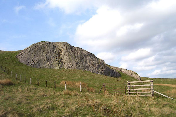 BPF81.jpg (taken 24.5.2008) |
||
|
|
||
| evidence:- | old map:- OS County Series (Wmd 27 3) placename:- Mere Crag |
|
| source data:- | Maps, County Series maps of Great Britain, scales 6 and 25
inches to 1 mile, published by the Ordnance Survey, Southampton,
Hampshire, from about 1863 to 1948. |
|
|
|
||
| evidence:- | map:- OS Six Inch (1956) placename:- Mere Crag |
|
| source data:- | Map series, various editions with the national grid, scale about
6 inches to 1 mile, published by the Ordnance Survey,
Southampton, Hampshire, scale 1 to 10560 from 1950s to 1960s,
then 1 to 10000 from 1960s to 2000s, superseded by print on
demand from digital data.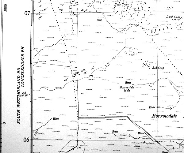 SINY5006.jpg "Mere Crag" across parish boundary |
|
|
|
||
 Lakes Guides menu.