 Old Cumbria Gazetteer
 |
 |
|
| Martindale | ||
| civil parish:- | Martindale (formerly Westmorland) | |
| county:- | Cumbria | |
| locality type:- | locality | |
| locality type:- | valley | |
| coordinates:- | NY43441602 (etc) | |
| 1Km square:- | NY4316 | |
| 10Km square:- | NY41 | |
|
|
||
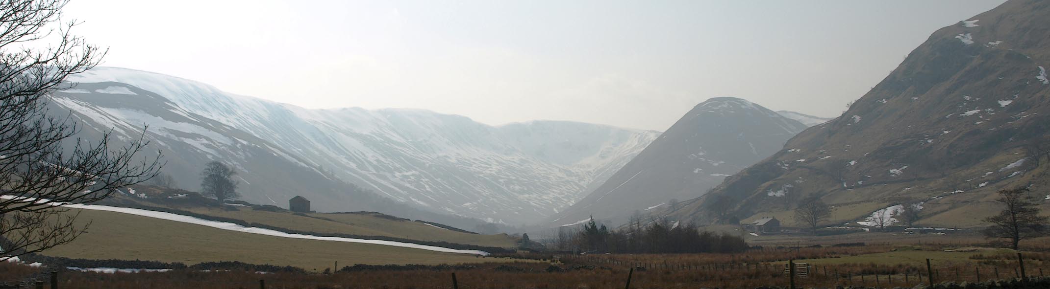 Click to enlarge BYB83.jpg (taken 10.4.2013) |
||
|
|
||
| evidence:- | old map:- Saxton 1579 placename:- Markendale Chapel |
|
| source data:- | Map, hand coloured engraving, Westmorlandiae et Cumberlandiae Comitatus ie Westmorland
and Cumberland, scale about 5 miles to 1 inch, by Christopher Saxton, London, engraved
by Augustinus Ryther, 1576, published 1579-1645.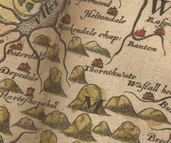 Sax9NY41.jpg Building, symbol for a hamlet, which may or may not have a nucleus. "Markendale chap:" item:- private collection : 2 Image © see bottom of page |
|
|
|
||
| evidence:- | old map:- Seller 1694 (Wmd) placename:- Markendale Chappell |
|
| source data:- | Map, hand coloured engraving, Westmorland, scale about 8 miles
to 1 inch, by John Seller, 1694. click to enlarge click to enlargeSEL7.jpg "Markendale Chappell" circle, italic lowercase text; settlement or house item:- Dove Cottage : 2007.38.87 Image © see bottom of page |
|
|
|
||
| evidence:- | old map:- Morden 1695 (Wmd) placename:- Martendale |
|
| source data:- | Map, hand coloured engraving, Westmorland, scale about 2.5 miles to 1 inch, by Robert
Morden, published by Abel Swale, the Unicorn, St Paul's Churchyard, Awnsham, and John
Churchill, the Black Swan, Paternoster Row, London, 1695.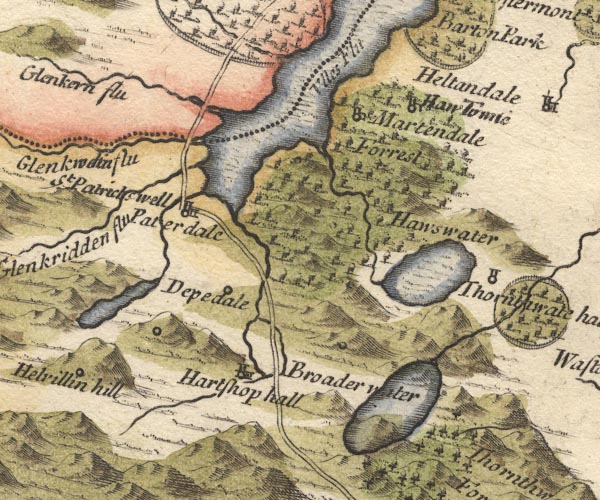 MD10NY41.jpg "Martendale" Circle, building and tower. item:- JandMN : 24 Image © see bottom of page |
|
|
|
||
| evidence:- | old map:- Badeslade 1742 placename:- Markendale |
|
| source data:- | Map, uncoloured engraving, A Map of Westmorland North from
London, scale about 10 miles to 1 inch, with descriptive text,
by Thomas Badeslade, London, engraved and published by William
Henry Toms, Union Court, Holborn, London, 1742. click to enlarge click to enlargeBD12.jpg "Markendale" circle, italic lowercase text; village, hamlet or locality item:- Dove Cottage : 2007.38.62 Image © see bottom of page |
|
|
|
||
| evidence:- | old map:- Jefferys 1770 (Wmd) placename:- Martindale |
|
| source data:- | Map, 4 sheets, The County of Westmoreland, scale 1 inch to 1
mile, surveyed 1768, and engraved and published by Thomas
Jefferys, London, 1770.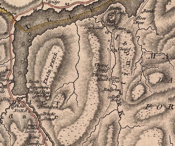 J5NY41NW.jpg "Martindale" hill hachuring; valley item:- National Library of Scotland : EME.s.47 Image © National Library of Scotland |
|
|
|
||
| evidence:- | old text:- Clarke 1787 placename:- Martindale |
|
| source data:- | Guide book, A Survey of the Lakes of Cumberland, Westmorland,
and Lancashire, written and published by James Clarke, Penrith,
Cumberland, and in London etc, 1787; published 1787-93. goto source goto sourcePage 34:- "..." "Martindale was a separate and independent manor, till it was granted by Queen Elizabeth to the Earl of Sussex as parcel of the barony of Barton; she reserving to herself and her successors grass for her pad when she came to hunt there; under this tenure it was bought by Sir Christopher Musgrave, along with the rest of the barony of Barton. The manor consists of small tenements, lying in different little glens, (such as Fuesdale, Boardale, Sandwich, &c.) those lands called the Forest excepted. The forest lands are held on the common forest tenure; the tenants having what grass they can take with the sythe. They likewise covenant not to drive the lord's deer out of it at any time of the year ..." |
|
|
|
||
| evidence:- | old map:- Cary 1789 (edn 1805) placename:- Martindale |
|
| source data:- | Map, uncoloured engraving, Westmoreland, scale about 2.5 miles
to 1 inch, by John Cary, London, 1789; edition 1805.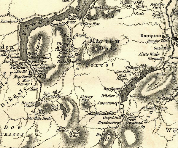 CY24NY41.jpg "Martindale" area item:- JandMN : 129 Image © see bottom of page |
|
|
|
||
| evidence:- | old map:- Cooper 1808 placename:- Martindale |
|
| source data:- | Map, hand coloured engraving, Westmoreland ie Westmorland, scale
about 9 miles to 1 inch, by H Cooper, 1808, published by R
Phillips, Bridge Street, Blackfriars, London, 1808. click to enlarge click to enlargeCOP4.jpg "Martindale" circle; village or hamlet item:- Dove Cottage : 2007.38.53 Image © see bottom of page |
|
|
|
||
| evidence:- | old text:- Wordsworth 1810 item:- forest; hunting; red deer; deer |
|
| source data:- | Guide book, A Description of the Scenery of the Lakes, later A
Guide through the District of The Lakes, by William Wordsworth,
1810-35. goto source page 126 "... while ascending a gentle slope along the valley of Martindale, we had occasion to observe that in thinly-peopled glens of this character the general want of wood gives a peculiar interest to the scattered cottages embowered in sycamore. Towards its head, this valley splits into two parts; and in one of these (that to the left) there is no house, nor any building to be seen but a cattle-shed on the side of a hill, which is sprinkled over with trees, evidently the remains of an extensive forest. Near the entrance of the other division stands the house where we were entertained, and beyond the enclosures of that farm there are no other. A few old trees remain, relics of the forest, a little stream hastens, though with serpentine windings, through the uncultivated hollow, where many cattle were pasturing. The cattle of this country are generally white, or light-coloured; but these were dark brown, or black, which heightened the resemblance this scene bears to many parts of the Highlands of Scotland. - While we paused to rest upon the hill-side, though well contented with the quiet every-day sounds - the lowing of cattle, bleating of sheep, and the very gentle murmuring of the valley stream, we could not but think what a grand effect" goto sourcepage 127 "the music of the bugle-horn would have among these mountains. It is still heard once every year, at the chase I have spoken of; a day of festivity for the inhabitants of this district except the poor deer, the most ancient of them all. Our ascent even to the top was very easy; when it was accomplished we had exceedingly fine views, ..." |
|
|
|
||
| evidence:- | old map:- Otley 1818 placename:- Martindale |
|
| source data:- | Map, uncoloured engraving, The District of the Lakes,
Cumberland, Westmorland, and Lancashire, scale about 4 miles to
1 inch, by Jonathan Otley, 1818, engraved by J and G Menzies,
Edinburgh, Scotland, published by Jonathan Otley, Keswick,
Cumberland, et al, 1833.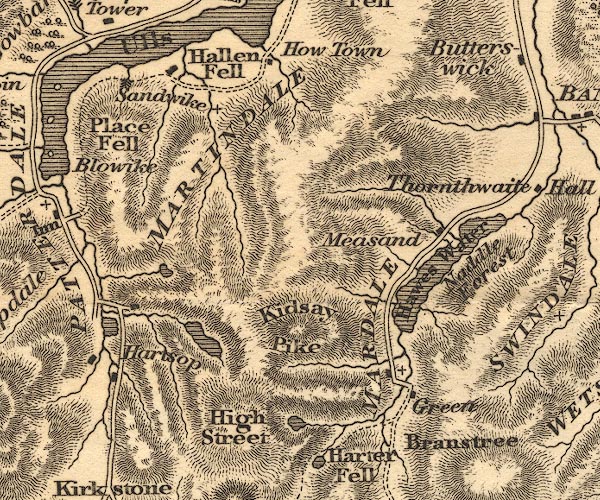 OT02NY41.jpg "MARTINDALE" item:- JandMN : 48.1 Image © see bottom of page |
|
|
|
||
| evidence:- | descriptive text:- Otley 1823 (5th edn 1834) item:- geology; red deer |
|
| source data:- | Guide book, A Concise Description of the English Lakes, the
mountains in their vicinity, and the roads by which they may be
visited, with remarks on the mineralogy and geology of the
district, by Jonathan Otley, published by the author, Keswick,
Cumberland now Cumbria, by J Richardson, London, and by Arthur
Foster, Kirkby Lonsdale, Cumbria, 1823; published 1823-49,
latterly as the Descriptive Guide to the English Lakes. goto source Page 47:- "... A few Red Deer are still remaining upon the Fells of Martindale." "..." goto sourcePage 155:- "The SECOND division [of slate rocks] comprehends the mountains of Eskdale, Wasdale, Ennerdale, Borrowdale, Langdale, Grasmere, Patterdale, Martindale, Mardale, and some adjacent places; including the two highest mountains of the district, Scawfell and Helvellyn, as well as the Old Man at Coniston. All our fine towering crags belong to it; and most of the cascades among the lakes fall over it. There are indeed some lofty precipices in the former division; ..." "..." |
|
|
|
||
| evidence:- | descriptive text:- Ford 1839 (3rd edn 1843) placename:- Martindale item:- yew; tree; sycamore |
|
| source data:- | Guide book, A Description of Scenery in the Lake District, by
Rev William Ford, published by Charles Thurnam, Carlisle, by W
Edwards, 12 Ave Maria Lane, Charles Tilt, Fleet Street, William
Smith, 113 Fleet Street, London, by Currie and Bowman,
Newcastle, by Bancks and Co, Manchester, by Oliver and Boyd,
Edinburgh, and by Sinclair, Dumfries, 1839. goto source Page 145:- "... leaving How Town, penetrate into Martindale, a sequestered spot shut out from the lake; its one-arched bridge, a chapel with low roof and simple bell-gable, and a picturesque yew-tree, are romantic objects. At the head of this dale, where it divides into two grains, is a hunting-box of the Hasell's. The want of wood here gives interest to the few scattered houses which are embowered in sycamore. ..." |
|
|
|
||
| evidence:- | old map:- Ford 1839 map placename:- Martindale |
|
| source data:- | Map, uncoloured engraving, Map of the Lake District of
Cumberland, Westmoreland and Lancashire, scale about 3.5 miles
to 1 inch, published by Charles Thurnam, Carlisle, and by R
Groombridge, 5 Paternoster Row, London, 3rd edn 1843.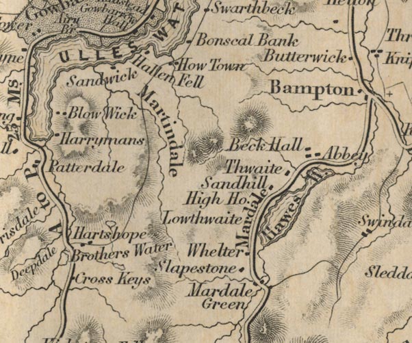 FD02NY41.jpg "Martindale" Alongside beck, between hill hachures. item:- JandMN : 100.1 Image © see bottom of page |
|
|
|
||
| evidence:- | old map:- Garnett 1850s-60s H placename:- Martindale |
|
| source data:- | Map of the English Lakes, in Cumberland, Westmorland and
Lancashire, scale about 3.5 miles to 1 inch, published by John
Garnett, Windermere, Westmorland, 1850s-60s.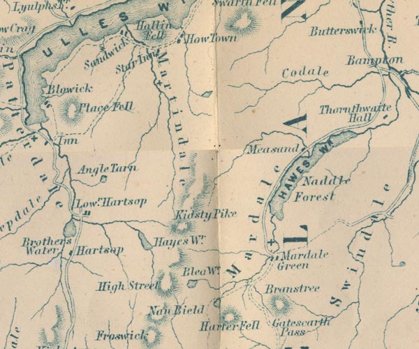 GAR2NY41.jpg "Martindale" area, river valley item:- JandMN : 82.1 Image © see bottom of page |
|
|
|
||
| evidence:- | old postcard:- |
|
| source data:- | Postcard, black and white photograph, near Sandwick, Martindale, Westmorland, published
by J L Topaz, Penrith, Cumberland, 1950s-60s?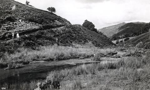 click to enlarge click to enlargePH0080.jpg printed at bottom "Martindale and the Road to Sandwick "A J. L. Topaz Production"" item:- JandMN : 948 Image © see bottom of page |
|
|
|
||
| evidence:- | outline view:- Tattersall 1836 placename:- Martindale |
|
| source data:- | Print, engraving, Lower Reach, Ullswater, from Pooley Bridge, Cumberland, drawn by
George Tattersall, engraved by W F Topham, published by Sherwood and Co, Paternoster
Row, London, about 1836.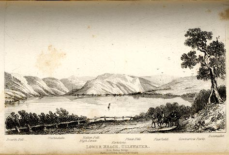 click to enlarge click to enlargeTAT140.jpg The print is captioned with mountain names and acts as an outline view. Tipped in opposite p.114 of The Lakes of England, by George Tattersall. printed at bottom:- "LOWER REACH, ULLSWATER, / from Pooley Bridge. / [London Pubd. ...]" printed at bottom left to right:- "Swarth Fell. / Martindale. / High Street. / Hallen Fell. / Kirkstone. / Place Fell. / Fairfield. / Gowbarrow Parks. / Dunmallet." item:- Armitt Library : A1204.41 Image © see bottom of page |
|
|
|
||
| evidence:- | outline view:- placename:- Martindale |
|
| source data:- | Print, hand coloured engraving, Lower Reach, Ullswater from Pooley Bridge, Westmorland
and Cumberland, published by Sherwood and Co, London, 1836?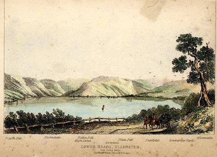 click to enlarge click to enlargePR0371.jpg Objects in the view are identified by a caption at the bottom - Swarth Fell, Martindale, High Street, Hallen Fell, Kirkstone, Place Fell, Fairfield, Gowbarrow Parks, Dumallet. printed at bottom:- "LOWER REACH, ULLSWATER. / from Pooley Bridge. / Pubd. April 15th 1836 by Sherwood &Co London." item:- Dove Cottage : 2008.107.371 Image © see bottom of page |
|
|
|
||
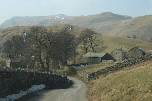 BYB81.jpg Coming over The Hause into the dale. (taken 10.4.2013) 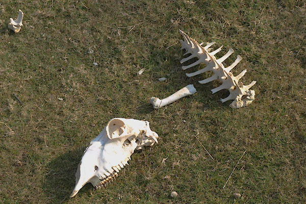 BYB85.jpg Not all sheep survive the winter. (taken 10.4.2013) |
||
|
|
||
| hearsay:- |
Between 1706 and 1739 there were 36 wild cats killed in Martindale; there was a bounty
on their heads at this time. |
|
| The bounty set on moles was three pence per acre to the parish molecatcher, 1566.
But in Martindale, 1826, a shilling an acre was allowed for moles that presumed to
burrow in the churchyard. |
||
|
|
||
Lakes Guides menu.