 Old Cumbria Gazetteer
 |
 |
|
| Lund Bridge, Nether Wasdale | ||
| Lund Bridge | ||
| site name:- | Irt, River | |
| locality:- | Wasdale | |
| civil parish:- | Nether Wasdale (formerly Cumberland) | |
| civil parish:- | Irton with Santon (formerly Cumberland) | |
| county:- | Cumbria | |
| locality type:- | bridge | |
| coordinates:- | NY14140390 | |
| 1Km square:- | NY1403 | |
| 10Km square:- | NY10 | |
|
|
||
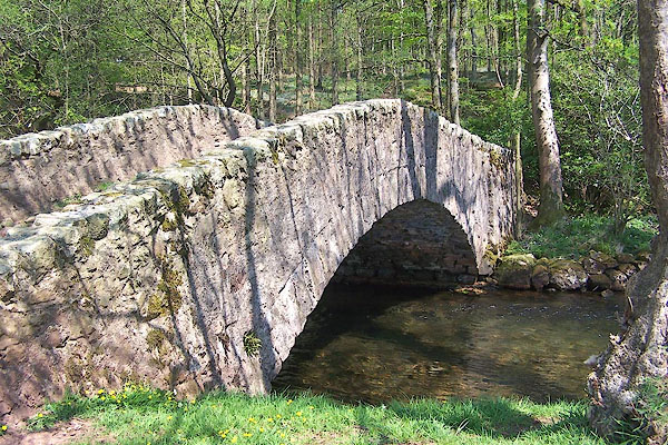 BMB69.jpg (taken 11.5.2006) |
||
|
|
||
| evidence:- | old map:- OS County Series (Cmd 79 5) placename:- Lund Bridge |
|
| source data:- | Maps, County Series maps of Great Britain, scales 6 and 25
inches to 1 mile, published by the Ordnance Survey, Southampton,
Hampshire, from about 1863 to 1948. |
|
|
|
||
| evidence:- | old print:- Green 1809 |
|
| source data:- | Print, soft ground etching, Bridge in Wasdale, Lund Bridge, Nether Wasdale, Cumberland,
by William Green, published by William Green, Ambleside, Westmorland, and Longman,
Hurst, Rees and Orme, Paternoster Row, London, 1809.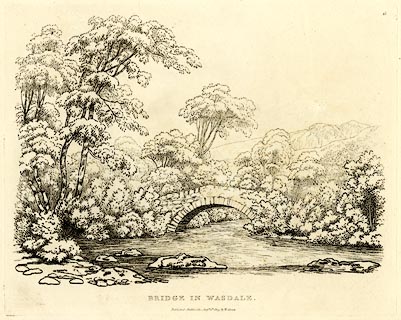 click to enlarge click to enlargeGN0345.jpg Plate 45 in Seventy Eight Studies from Nature. printed in introductory pages to set of prints:- "Number 45. Nether Wasdale is at the foot of Wastwater, and Wasdale head at the head of the lake, which lies in a right line, about fourteen miles north-west of Ambleside. This bridge is over the river Irt, about half a mile from the foot of the lake." printed at bottom:- "BRIDGE IN WASDALE. / Published Ambleside, Augst. 1st. 1809, by W. Green." item:- Armitt Library : A6637.45 Image © see bottom of page |
|
|
|
||
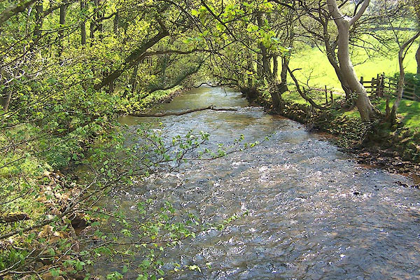 BMB70.jpg View of river. (taken 11.5.2006) |
||
|
|
||
 Lakes Guides menu.