 |
 |
|
|
|
|
|
| civil parish:- |
Lowca (formerly Cumberland) |
| county:- |
Cumbria |
| old county:- |
Cumberland |
| locality type:- |
locality |
| locality type:- |
buildings |
| coordinates:- |
NX98412173 (etc) |
| 1Km square:- |
NX9821 |
| 10Km square:- |
NX92 |
|
|
| evidence:- |
old map:- Donald 1774 (Cmd)
placename:- Loucay
|
| source data:- |
Map, hand coloured engraving, 3x2 sheets, The County of Cumberland, scale about 1
inch to 1 mile, by Thomas Donald, engraved and published by Joseph Hodskinson, 29
Arundel Street, Strand, London, 1774.
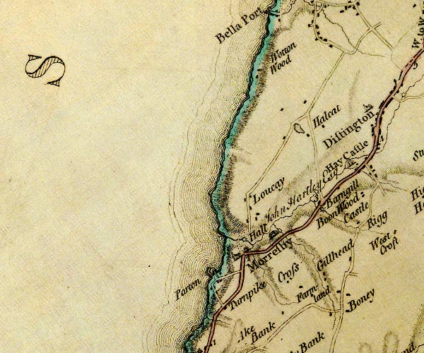
D4NX92SE.jpg
"Loucay"
block or blocks, labelled in lowercase; a hamlet or just a house
item:- Carlisle Library : Map 2
Image © Carlisle Library |
|
|
| places:- |
 |
NX98362181 Croft Head (Lowca) |
|
|
|
NX98272199 High Lowca (Lowca) |
|
|
|
NX98312152 Low Lowca (Lowca) |
|
|
|
NX98072122 Lowca Foundry (Lowca) gone |
|
|
|
NX97852157 Lowca Point (Lowca) |
|
|
|
NX9821 Lowca Station (Lowca) |
|
|
|
NX97792168 salt pans, Lowca (Lowca) gone? |
|
|
|
NX98712178 Ship Inn (Lowca) |
|
|
|
NX98522155 Stamford Hill Farm (Lowca) |
|
|
|
NX99552168 milestone, Moresby (Moresby) |
|
