 Old Cumbria Gazetteer
 |
 |
|
| Low Bowkerstead, Satterthwaite | ||
| Low Bowkerstead | ||
| civil parish:- | Satterthwaite (formerly Lancashire) | |
| county:- | Cumbria | |
| locality type:- | buildings | |
| coordinates:- | SD33689133 (?) | |
| 1Km square:- | SD3391 | |
| 10Km square:- | SD39 | |
|
|
||
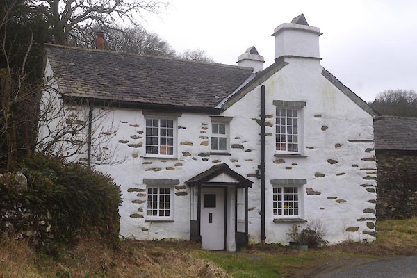 CES44.jpg (taken 11.3.2016) |
||
|
|
||
| evidence:- | old map:- OS County Series (Lan 8 1) placename:- Low Bowkerstead placename:- Bowkerstead, Low |
|
| source data:- | Maps, County Series maps of Great Britain, scales 6 and 25
inches to 1 mile, published by the Ordnance Survey, Southampton,
Hampshire, from about 1863 to 1948. |
|
|
|
||
| evidence:- | database:- Listed Buildings 2010 placename:- Low Bowkerstead |
|
| source data:- | courtesy of English Heritage "LOW BOWKERSTEAD AND BARN / / / SATTERTHWAITE / SOUTH LAKELAND / CUMBRIA / II / 76879 / SD3369191332" |
|
|
|
||
 Lakes Guides menu.