 Old Cumbria Gazetteer
 |
 |
|
| Lost Johns' Cave, North Yorkshire | ||
| Lost Johns' Cave | ||
| Lost John's Cave | ||
| Lost John's System | ||
| site name:- | Gragareth | |
| county:- | North Yorkshire | |
| locality type:- | cave | |
| locality type:- | pothole | |
| coordinates:- | SD67077867 | |
| 1Km square:- | SD6778 | |
| 10Km square:- | SD67 | |
| altitude:- | 1160 feet | |
| altitude:- | 354m | |
| SummaryText:- | Considering the local tale about the cave the plural Johns' is more likely correct; the OS use the singular John's. | |
| SummaryText:- | All grades to grade IV; 3 miles of caves; permission from Council of Northern Caving Clubs. | |
| references:- | Brook, D & Davies, G & Long, M H &Sutcliffe, J R: 1975: Northern Caves, vol.4 Whernside
and Gragareth: Dalesman Books:: ISBN 0 85206 259 1 |
|
|
|
||
| evidence:- | descriptive text:- Balderston c1890 placename:- Lost Johns' Hole placename:- John is coming Hole |
|
| source data:- | Book, Ingleton, Bygone and Present, by Robert R and Margaret
Balderston, published by Simpkin, Marshall and Co, London, and
by Edmndson and Co, 24 High Street, Skipton, Yorkshire, about
1890. goto source goto sourcepage 69:- "Lost Johns' Hole." "Turning now to the western side of the Greygareth mountain, passing through Ireby, if making the excursion from Ingleton, and proceeding along the lane behind Leck Hall, so as to follow the allotment road that skirts the slopes of the upper fell-land, one at length reaches the only farm house in the higher portion of that side of the valley, namely Leck Fell House, but it is on the next pasture but one on the south-western side of this building, an enclosure called Fenwick's Allotment, that we must centre our attention, for it is rich in wonders. At the lower end of that portion of the field which is above the road there is a slight hollow, becoming deeper at the point where it meets the boundary wall, and in this depression is the mouth of Lost Johns' Cave, sometimes called 'John is coming Hole,' owing to two men - both of whom were named John - having once, after their candles had gone out, utterly lost their way. 'Nay, I'll show you the manner of it,' for the very showing gives a description of the chief peculiarity of the cavern. Now, this cave, strictly speaking, is neither one of debouchure nor engulfment; it has neither upward nor downward mouth, but owing to a very much contracted and lateral passage, which may be a conduit for water in wet weather, and is about seventeen yards in length, access is obtained, by passing warily along, to the main cavern, which extends in an upward and downward direction at the point of juncture. Here it is as well to leave a wet fleece of wool, about eight or nine inches long, sticking to the rock at the corner of the inconspicuous opening to the passage of egress, so as to be a clue to the secret of the labyrinth. The cave is now more spacious, and after having proceeded some distance further another large passage comes from the left. about ninety-two yards from the mouth is a waterfall" goto sourcepage 70:- "which can be descended, and it is here that certain stalactites must be noted, particularly one which appears, by the dim light of a couple of candles, like a Rhizostoma. During our progress for a distance of two hundred and twenty-two yards, the cavern became decidedly lofty, though still narrow, reaching a height of fully thirty feet. In the backward journey the cave-hunter, if wishing to leave his tenement, must turn twice to the left during the last furlong, otherwise he may find himself investigating other mysteries in the bosom of Greygareth; therefore, take at least four candles for each person." |
|
|
|
||
| evidence:- | old map:- Balderston c1890 map placename:- Lost John's Cave |
|
| source data:- | Map, the hills in the Ingleton area, probably by Robert R
Balderston, engraved by Goodall and Suddick, Leeds, West
Yorkshire, about 1890.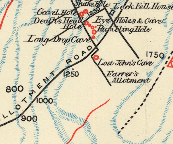 BS1SD67U.jpg "Lost John's Cave" item:- private collection : 27.1 Image © see bottom of page |
|
|
|
||
Lakes Guides menu.