 Old Cumbria Gazetteer
 |
 |
|
| Longpark, Scaleby | ||
| Longpark | ||
| civil parish:- | Scaleby (formerly Cumberland) | |
| county:- | Cumbria | |
| locality type:- | park | |
| locality type:- | buildings | |
| coordinates:- | NY42626189 | |
| 1Km square:- | NY4261 | |
| 10Km square:- | NY46 | |
|
|
||
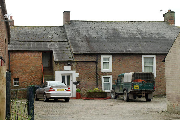 BYO04.jpg (taken 14.6.2013) |
||
|
|
||
| evidence:- | old map:- Donald 1774 (Cmd) placename:- Long Park |
|
| source data:- | Map, hand coloured engraving, 3x2 sheets, The County of Cumberland, scale about 1
inch to 1 mile, by Thomas Donald, engraved and published by Joseph Hodskinson, 29
Arundel Street, Strand, London, 1774.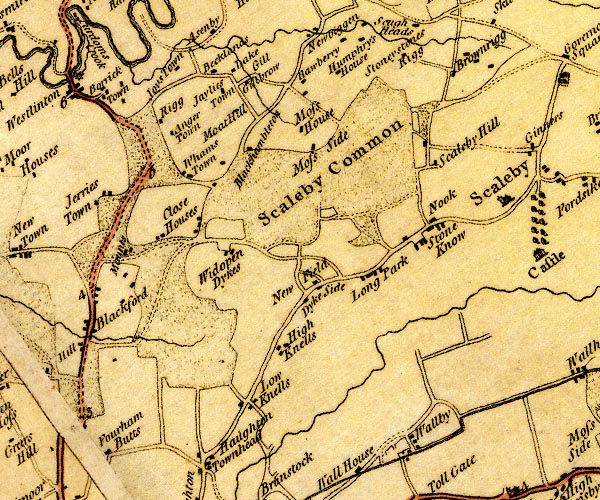 D4NY46SW.jpg "Long Park" block or blocks, labelled in lowercase; a hamlet or just a house item:- Carlisle Library : Map 2 Image © Carlisle Library |
|
|
|
||
| evidence:- | database:- Listed Buildings 2010 placename:- Longpark item:- date stone (1831) |
|
| source data:- | courtesy of English Heritage "LONGPARK TO NORTH EAST OF CEDAR LODGE / / / SCALEBY / CARLISLE / CUMBRIA / II / 77964 / NY4262261892" |
|
|
|
||
 Lakes Guides menu.