 Old Cumbria Gazetteer
 |
 |
|
| Long Gill | ||
| county:- | North Yorkshire | |
| locality type:- | river | |
| coordinates:- | SD71167985 | |
| 1Km square:- | SD7179 | |
| 10Km square:- | SD77 | |
|
|
||
| evidence:- | descriptive text:- Balderston c1890 |
|
| source data:- | Book, Ingleton, Bygone and Present, by Robert R and Margaret
Balderston, published by Simpkin, Marshall and Co, London, and
by Edmndson and Co, 24 High Street, Skipton, Yorkshire, about
1890. goto source goto sourcepage 78:- "..." "At the head of Long Gill, in Kingsdale, is a fall fifteen feet in height, formed by two leaps - one of eleven and one of four feet. ..." |
|
|
|
||
| evidence:- | old map:- Balderston c1890 map placename:- Long Gill |
|
| source data:- | Map, the hills in the Ingleton area, probably by Robert R
Balderston, engraved by Goodall and Suddick, Leeds, West
Yorkshire, about 1890.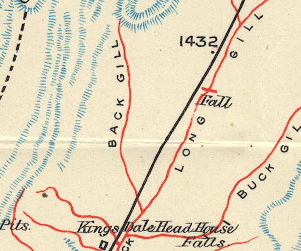 BS1SD78A.jpg "LONG GILL" item:- private collection : 27.1 Image © see bottom of page |
|
|
|
||
Lakes Guides menu.