 Old Cumbria Gazetteer
 |
 |
|
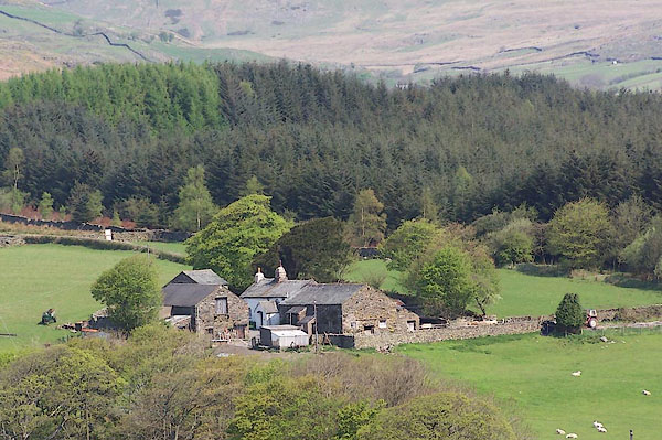
| Loganbeck, Ulpha | ||
| Loganbeck | ||
| civil parish:- | Ulpha (formerly Cumberland) | |
| county:- | Cumbria | |
| locality type:- | buildings | |
| coordinates:- | SD18319046 | |
| 1Km square:- | SD1890 | |
| 10Km square:- | SD19 | |
|
|
||
 BMB27.jpg (taken 11.5.2006) 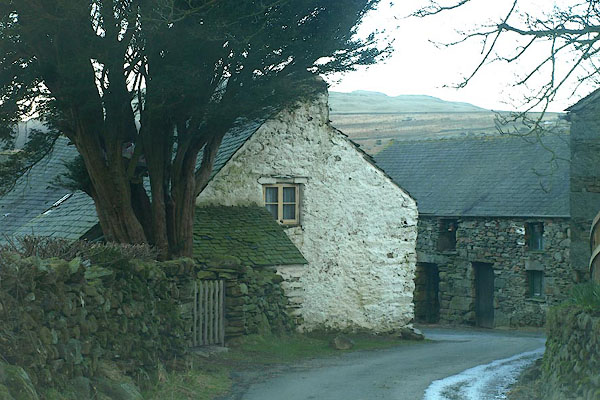 BOS07.jpg (taken 27.2.2008) |
||
|
|
||
| evidence:- | old map:- OS County Series (Cmd 86 7) placename:- Loganbeck |
|
| source data:- | Maps, County Series maps of Great Britain, scales 6 and 25
inches to 1 mile, published by the Ordnance Survey, Southampton,
Hampshire, from about 1863 to 1948. |
|
|
|
||
| evidence:- | old map:- Donald 1774 (Cmd) placename:- Logan Beck |
|
| source data:- | Map, hand coloured engraving, 3x2 sheets, The County of Cumberland, scale about 1
inch to 1 mile, by Thomas Donald, engraved and published by Joseph Hodskinson, 29
Arundel Street, Strand, London, 1774.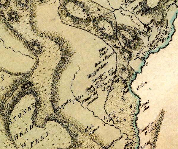 D4SD19SE.jpg "Logan Beck" block or blocks, labelled in lowercase; a hamlet or just a house item:- Carlisle Library : Map 2 Image © Carlisle Library |
|
|
|
||
| evidence:- | database:- Listed Buildings 2010 placename:- Loganbeck Farm |
|
| source data:- | courtesy of English Heritage "LOGANBECK FARMHOUSE AND ADJOINING BARN / / / ULPHA / COPELAND / CUMBRIA / II / 76284 / SD1831490466" |
|
|
|
||
 Lakes Guides menu.