 Old Cumbria Gazetteer
 |
 |
|
| Little Tarn, Orthwaite | ||
| Little Tarn | ||
| locality:- | Orthwaite | |
| civil parish:- | Ireby (formerly Cumberland) | |
| county:- | Cumbria | |
| locality type:- | tarn | |
| coordinates:- | NY24883380 (etc) | |
| 1Km square:- | NY2433 | |
| 10Km square:- | NY23 | |
| altitude:- | 650 feet | |
| altitude:- | 198m | |
|
|
||
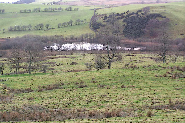 BOJ51.jpg (taken 29.11.2007) |
||
|
|
||
| evidence:- | old map:- OS County Series (Cmd 47 9) placename:- Tarn Nevin |
|
| source data:- | Maps, County Series maps of Great Britain, scales 6 and 25
inches to 1 mile, published by the Ordnance Survey, Southampton,
Hampshire, from about 1863 to 1948. |
|
|
|
||
| evidence:- | old map:- Donald 1774 (Cmd) |
|
| source data:- | Map, hand coloured engraving, 3x2 sheets, The County of Cumberland, scale about 1
inch to 1 mile, by Thomas Donald, engraved and published by Joseph Hodskinson, 29
Arundel Street, Strand, London, 1774.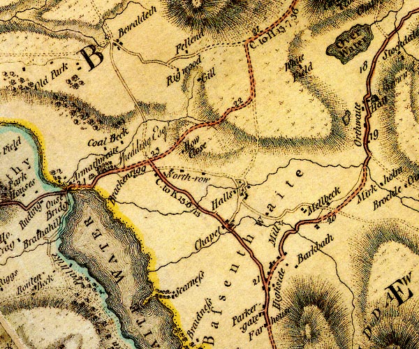 D4NY23SW.jpg lake, at Orthwaite item:- Carlisle Library : Map 2 Image © Carlisle Library |
|
|
|
||
| evidence:- | old map:- Otley 1818 |
|
| source data:- | Map, uncoloured engraving, The District of the Lakes,
Cumberland, Westmorland, and Lancashire, scale about 4 miles to
1 inch, by Jonathan Otley, 1818, engraved by J and G Menzies,
Edinburgh, Scotland, published by Jonathan Otley, Keswick,
Cumberland, et al, 1833.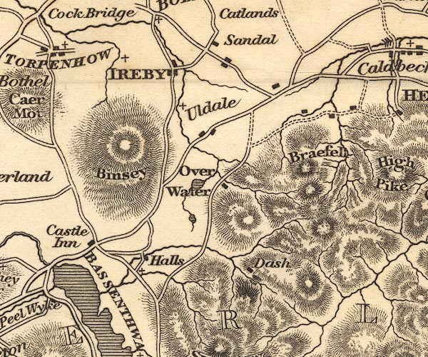 OT02NY23.jpg On the stream above Over Water. item:- JandMN : 48.1 Image © see bottom of page |
|
|
|
||
 Lakes Guides menu.