 Old Cumbria Gazetteer
 |
 |
|
| Langholm, Scotland | ||
| Langholm | ||
| country:- | Scotland | |
| locality type:- | buildings | |
| coordinates:- | NY364848 | |
| 1Km square:- | NY3684 | |
| 10Km square:- | NY38 | |
|
|
||
| evidence:- | old map:- Burghley 1590 (facsimile) placename:- Langhame, Ye |
|
| source data:- | Facsimile map, A Platt of the Opposete Border of Scotland to ye West Marches of England,
parts of Cumberland and Scotland including the Debateable Land, from a manuscript
drawn for William Cecil, Lord Burghley, about 1590, published by R B Armstrong, 1897. courtesy of the National Library of Scotland 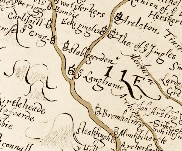 M048NY38.jpg "ye Langhame" circle, tower item:- National Library of Scotland : MS6113 f.267 Image © National Library of Scotland |
|
|
|
||
| evidence:- | old map:- Ford 1839 map placename:- Langholm |
|
| source data:- | Map, uncoloured engraving, Map of the Lake District of
Cumberland, Westmoreland and Lancashire, scale about 3.5 miles
to 1 inch, published by Charles Thurnam, Carlisle, and by R
Groombridge, 5 Paternoster Row, London, 3rd edn 1843.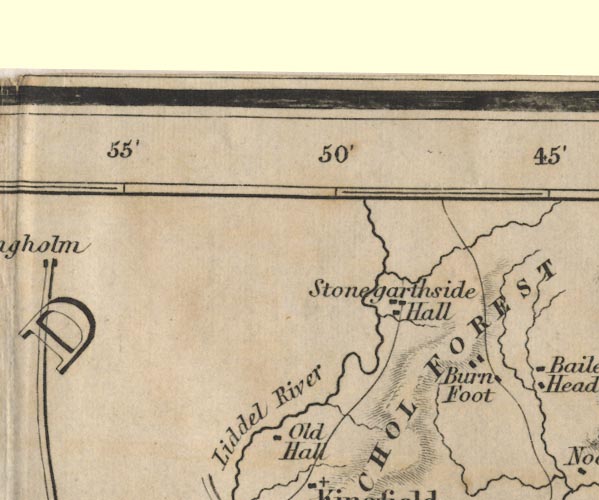 FD02NY48.jpg "Langholm" item:- JandMN : 100.1 Image © see bottom of page |
|
|
|
||
 Lakes Guides menu.