 Old Cumbria Gazetteer
 |
 |
|
| Landing How, Lakeside | ||
| Landing How | ||
| locality:- | Lakeside | |
| civil parish:- | Colton (formerly Lancashire) | |
| county:- | Cumbria | |
| locality type:- | buildings | |
| coordinates:- | SD377871 | |
| 1Km square:- | SD3787 | |
| 10Km square:- | SD38 | |
|
|
||
| evidence:- | old map:- OS County Series (Lan 8 15) placename:- Landing |
|
| source data:- | Maps, County Series maps of Great Britain, scales 6 and 25
inches to 1 mile, published by the Ordnance Survey, Southampton,
Hampshire, from about 1863 to 1948. |
|
|
|
||
| evidence:- | old map:- Crosthwaite 1783-94 (Win/Ble) placename:- Landing |
|
| source data:- | Map, uncoloured engraving, An Accurate Map of the Grand Lake of
Windermere, scale about 2 inches to 1 mile, by Peter
Crosthwaite, Keswick, Cumberland, 1783, version published 1819.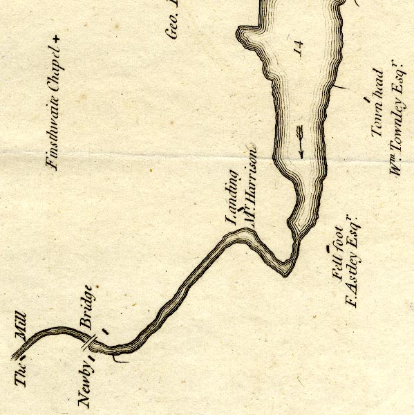 CT9SD38T.jpg "Landing / Mr. Harrison" block, building/s item:- Armitt Library : 2008.14.102 Image © see bottom of page |
|
|
|
||
| evidence:- | old text:- Clarke 1787 placename:- Landing item:- sand |
|
| source data:- | Guide book, A Survey of the Lakes of Cumberland, Westmorland,
and Lancashire, written and published by James Clarke, Penrith,
Cumberland, and in London etc, 1787; published 1787-93. goto source goto sourcePage 152:- "..." "The Lake exhibits much the same appearance as far as Landing, near which Mr Harrison has made some improvements: In this place, and within half a mile, the soil is not above a yard thick, under which is fine small sand, without the smallest mixture of vegetative earth. This sand the inhabitants use for all purposes of river sand, mixing their lime, and covering the roads with it. I cannot imagine, (unless we suppose the Lake to have been larger formerly than at present) how this sand could come here; no flood, (the deluge excepted) could rise so high; and as the same strata are found on both sides of the water, we must conclude that the cause, be what it will, must have been very extensive." |
|
|
|
||
| evidence:- | old map:- Clarke 1787 map (Windermere S) placename:- Landing |
|
| source data:- | Map, A Map of the Southern Part of the Lake Winandermere and its
Environs, scale about 6.5 ins to 1 mile, by James Clarke,
engraved by Samuel John Neele, 352 Strand, published by James
Clarke, Penrith, Cumberland and in London etc, 1787.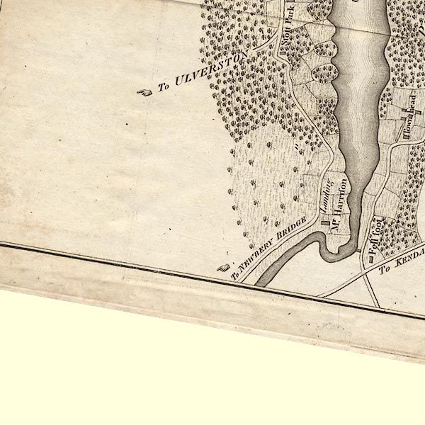 CLBSD38T.jpg "Landing / Mr. Harrison" item:- private collection : 10.11 Image © see bottom of page |
|
|
|
||
| evidence:- | probably old map:- Ford 1839 map |
|
| source data:- | Map, uncoloured engraving, Map of the Lake District of
Cumberland, Westmoreland and Lancashire, scale about 3.5 miles
to 1 inch, published by Charles Thurnam, Carlisle, and by R
Groombridge, 5 Paternoster Row, London, 3rd edn 1843.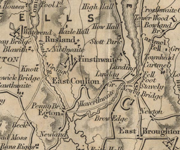 FD02SD38.jpg "Landing" item:- JandMN : 100.1 Image © see bottom of page |
|
|
|
||
Lakes Guides menu.