 Old Cumbria Gazetteer
 |
 |
|
| Kinniside Common, Ennerdale and Kinniside | ||
| Kinniside Common | ||
| locality:- | Kinniside | |
| civil parish:- | Ennerdale and Kinniside (formerly Cumberland) | |
| county:- | Cumbria | |
| locality type:- | common | |
| coordinates:- | NY08621191 (etc etc) | |
| 1Km square:- | NY0811 | |
| 10Km square:- | NY01 | |
|
|
||
| evidence:- | old map:- Donald 1774 (Cmd) placename:- Cold Fell |
|
| source data:- | Map, hand coloured engraving, 3x2 sheets, The County of Cumberland, scale about 1
inch to 1 mile, by Thomas Donald, engraved and published by Joseph Hodskinson, 29
Arundel Street, Strand, London, 1774.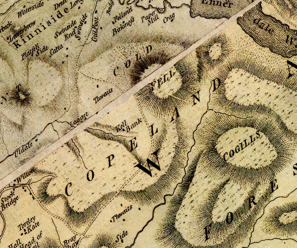 D4NY01SE.jpg "COLD FELL" hill hachuring; a hill or mountain item:- Carlisle Library : Map 2 Image © Carlisle Library |
|
|
|
||
| evidence:- | descriptive text:- West 1778 (11th edn 1821) |
|
| source data:- | Guide book, A Guide to the Lakes, by Thomas West, published by
William Pennington, Kendal, Cumbria once Westmorland, and in
London, 1778 to 1821. goto source goto sourceAccount of Ennerdale, late 18th century Page 295:- "..." "... The lake of Ennerdale appears in view. To the left, a majestic wood, rising gradually up the side of Cold-fell from the opposite shore of the water, imparts the most graceful ornament to the entrance into a region perfectly different from the last. ..." |
|
|
|
||
| evidence:- | old map:- Ford 1839 map placename:- Cold Fell |
|
| source data:- | Map, uncoloured engraving, Map of the Lake District of
Cumberland, Westmoreland and Lancashire, scale about 3.5 miles
to 1 inch, published by Charles Thurnam, Carlisle, and by R
Groombridge, 5 Paternoster Row, London, 3rd edn 1843.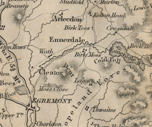 FD02NY01.jpg "Cold Fell" Hill hachuring. item:- JandMN : 100.1 Image © see bottom of page |
|
|
|
||
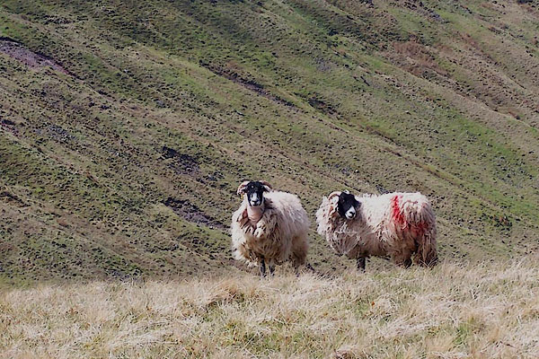 BUL76.jpg Swaledale sheep, probably from Smaithwaite, Lamplugh, smit mark:- "red half crupper on near side, red pop on head" (taken 27.4.2011) |
||
|
|
||
Lakes Guides menu.