 Old Cumbria Gazetteer
 |
 |
|
| chapel, Cockermouth (2) | ||
| Kings Church | ||
| United Reform Church | ||
| Street:- | Main Street | |
| locality:- | Cockermouth | |
| civil parish:- | Cockermouth (formerly Cumberland) | |
| county:- | Cumbria | |
| locality type:- | chapel | |
| coordinates:- | NY11933073 | |
| 1Km square:- | NY1130 | |
| 10Km square:- | NY13 | |
| references:- | Listed Buildings 2010 |
|
|
|
||
 BYP31.jpg (taken 21.6.2013) |
||
|
|
||
| evidence:- | old map:- OS County Series (Cmd 54 4) |
|
| source data:- | Maps, County Series maps of Great Britain, scales 6 and 25
inches to 1 mile, published by the Ordnance Survey, Southampton,
Hampshire, from about 1863 to 1948. "Independent Chapel (Calvinist)" |
|
|
|
||
| evidence:- | probably old map:- Donald 1774 (Cmd) |
|
| source data:- | Map, hand coloured engraving, 3x2 sheets, The County of Cumberland, scale about 1
inch to 1 mile, by Thomas Donald, engraved and published by Joseph Hodskinson, 29
Arundel Street, Strand, London, 1774.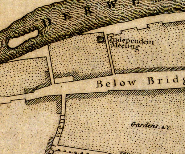 D41130Y.jpg "Independent Meeting" building item:- Carlisle Library : Map 2 Image © Carlisle Library |
|
|
|
||
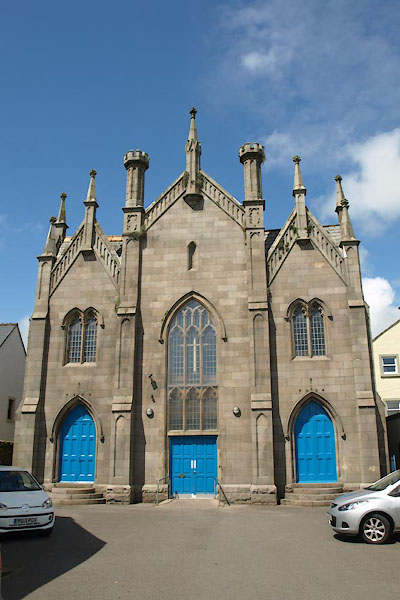
| evidence:- | database:- Listed Buildings 2010 placename:- Congregational Church |
|
| source data:- | courtesy of English Heritage "CONGREGATIONAL CHURCH / / MAIN STREET / COCKERMOUTH / ALLERDALE / CUMBRIA / II / 71714 / NY1193330735" |
|
| source data:- | courtesy of English Heritage "1856, Perpendicular style of thin detail. Symmetrical front of 3 gables with pinnacles on peaks, and tall panelled turrets crowning thin buttresses. Centre has a Perpendicular 3-light window. Flanking pointed-arched doorways, with a 2-light window above each. Set in front of older Sunday School." |
|
|
|
||
 Lakes Guides menu.