 Old Cumbria Gazetteer
 |
 |
|
| Killhope Law, Northumberland | ||
| Killhope Law | ||
| county:- | Northumberland | |
| county:- | Durham | |
| locality type:- | hill | |
| locality type:- | trig point | |
| coordinates:- | NY81954856 (?) | |
| 1Km square:- | NY8148 | |
| 10Km square:- | NY84 | |
| altitude:- | 2208 feet | |
| altitude:- | 673m | |
|
|
||
| evidence:- | old map:- Saxton 1579 placename:- Kellop Law Hill |
|
| source data:- | Map, hand coloured engraving, Westmorlandiae et Cumberlandiae Comitatus ie Westmorland
and Cumberland, scale about 5 miles to 1 inch, by Christopher Saxton, London, engraved
by Augustinus Ryther, 1576, published 1579-1645.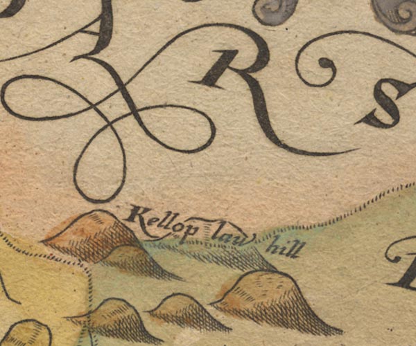 Sax9NY84.jpg "Kellop law hill" item:- private collection : 2 Image © see bottom of page |
|
|
|
||
| evidence:- | old map:- Simpson 1746 map (Wmd) placename:- Kelloplaw Hill |
|
| source data:- | Map, uncoloured engraving, Westmorland, scale about 8 miles to 1
inch, printed by R Walker, Fleet Lane, London, 1746.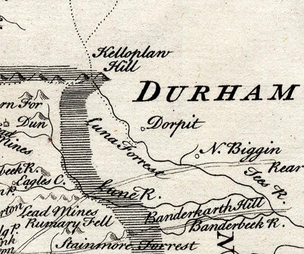 SMP2NYW.jpg "Kelloplaw Hill" Hillock; on boundary with Cumberland, Durham, and Yorkshire. item:- Dove Cottage : 2007.38.59 Image © see bottom of page |
|
|
|
||
| evidence:- | old map:- Bowen and Kitchin 1760 placename:- Kelloplaw Hill |
|
| source data:- | Map, hand coloured engraving, A New Map of the Counties of
Cumberland and Westmoreland Divided into their Respective Wards,
scale about 4 miles to 1 inch, by Emanuel Bowen and Thomas
Kitchin et al, published by T Bowles, Robert Sayer, and John
Bowles, London, 1760.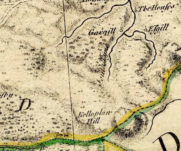 BO18NY73.jpg "Kelloplaw Hill" hill hachuring, on county boundary Cumberland Durham item:- Armitt Library : 2008.14.10 Image © see bottom of page |
|
|
|
||
 Lakes Guides menu.