 Old Cumbria Gazetteer
 |
 |
|
| Keld Head, North Yorkshire | ||
| Keld Head | ||
| county:- | North Yorkshire | |
| locality type:- | spring | |
| coordinates:- | SD69587659 | |
| 1Km square:- | SD6976 | |
| 10Km square:- | SD67 | |
|
|
||
| evidence:- | descriptive text:- West 1778 (11th edn 1821) placename:- Keld's Head |
|
| source data:- | Guide book, A Guide to the Lakes, by Thomas West, published by
William Pennington, Kendal, Cumbria once Westmorland, and in
London, 1778 to 1821. goto source goto sourceTour to the Caves in the West Riding of Yorkshire, late 18th century Page 245:- "... About a mile higher [than Thornton Force] we came to the head of the river, which issues from one fountain called Keld's-head, [1] to all appearance more copious than St. Winifred's Well, in Flintshire; though there is a broken, serpentine, irregular channel, extending to the top of the vale, down which a large stream is poured from the mountains in rainy weather. ..." "[1] Keld seems the ancient Saxon or British word for spring or fountain and is often made use of in that sense in these parts of Yorkshire" |
|
|
|
||
| evidence:- | old map:- Balderston c1890 map placename:- Keld Head |
|
| source data:- | Map, the hills in the Ingleton area, probably by Robert R
Balderston, engraved by Goodall and Suddick, Leeds, West
Yorkshire, about 1890.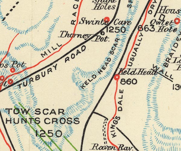 BS1SD67Y.jpg "Keld Head" item:- private collection : 27.1 Image © see bottom of page |
|
|
|
||
Lakes Guides menu.