 Old Cumbria Gazetteer
 |
 |
|
| Inglewood Inn Farm, Penrith | ||
| Inglewood Inn Farm | ||
| civil parish:- | Penrith (formerly Cumberland) | |
| county:- | Cumbria | |
| locality type:- | buildings | |
| coordinates:- | NY50653323 | |
| 1Km square:- | NY5033 | |
| 10Km square:- | NY53 | |
|
|
||
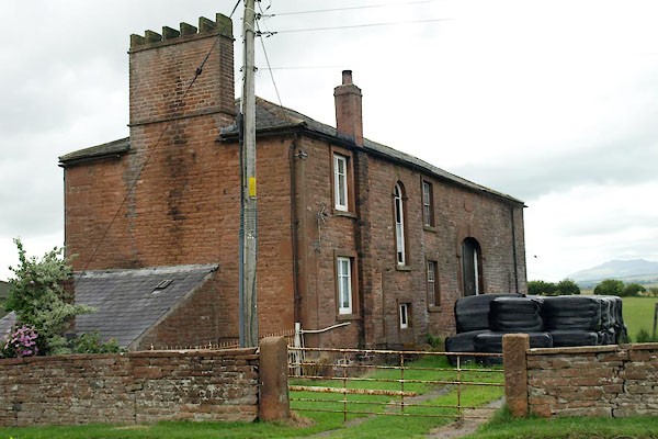 BYX61.jpg (taken 2.8.2013) 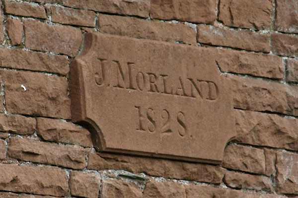 BYX62.jpg Date stone on barn:- "J. MORLAND / 1828." (taken 2.8.2013) |
||
|
|
||
| evidence:- | old map:- OS County Series (Cmd 49 12) placename:- Inglewood Inn |
|
| source data:- | Maps, County Series maps of Great Britain, scales 6 and 25
inches to 1 mile, published by the Ordnance Survey, Southampton,
Hampshire, from about 1863 to 1948. |
|
|
|
||
| evidence:- | old text:- Harper 1907 placename:- |
|
| source data:- | Guidebook, The Manchester and Glasgow Road, by Charles G Harper,
published by Chapman and Hall Ltd, London, 1907. HP01p136.txt Page 136:- "... passing the "Inglewood" inn, which seems forlornly to wonder what has become of the traffic, it [road, Penrith to Carlisle] rejoins the existing highway ..." |
|
|
|
||
| evidence:- | database:- Listed Buildings 2010 placename:- Inglewood Inn Farm item:- date stone (1828) |
|
| source data:- | courtesy of English Heritage "INGLEWOOD INN FARMHOUSE AND INTEGRAL FARM BUILDINGS / / INGLEWOOD ROAD / PENRITH / EDEN / CUMBRIA / II / 72873 / NY5065033234" |
|
|
|
||
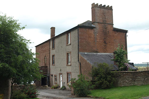 BYX60.jpg (taken 2.8.2013) |
||
|
|
||
 Lakes Guides menu.