 Old Cumbria Gazetteer
 |
 |
|
| Hunter's Holme, Arthuret | ||
| Hunter's Holme | ||
| civil parish:- | Arthuret (formerly Cumberland) | |
| county:- | Cumbria | |
| locality type:- | buildings | |
| coordinates:- | NY42676729 | |
| 1Km square:- | NY4267 | |
| 10Km square:- | NY46 | |
|
|
||
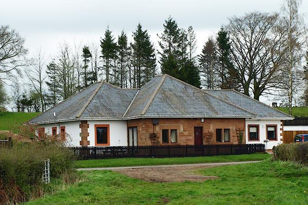 BQJ81.jpg (taken 11.4.2009) 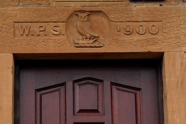 BQJ82.jpg Date stone, "W.P.S. 1900" and a crest, an owl. (taken 11.4.2009) |
||
|
|
||
| evidence:- | old map:- OS County Series (Cmd 10 8) placename:- Hunter's Holme |
|
| source data:- | Maps, County Series maps of Great Britain, scales 6 and 25
inches to 1 mile, published by the Ordnance Survey, Southampton,
Hampshire, from about 1863 to 1948. |
|
|
|
||
| evidence:- | old map:- Donald 1774 (Cmd) placename:- Hunter Holm |
|
| source data:- | Map, hand coloured engraving, 3x2 sheets, The County of Cumberland, scale about 1
inch to 1 mile, by Thomas Donald, engraved and published by Joseph Hodskinson, 29
Arundel Street, Strand, London, 1774.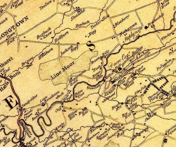 D4NY46NW.jpg "Hunter Holm" block or blocks, labelled in lowercase; a hamlet or just a house item:- Carlisle Library : Map 2 Image © Carlisle Library |
|
|
|
||
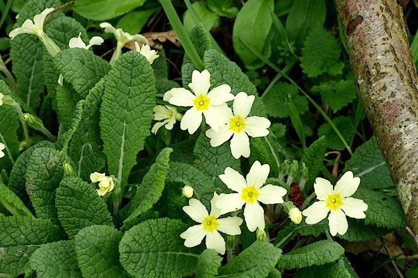 BQJ80.jpg Primroses nearby. (taken 11.4.2009) |
||
|
|
||
 Lakes Guides menu.