 Old Cumbria Gazetteer
 |
 |
|
| How Hill, Thursby | ||
| How Hill | ||
| civil parish:- | Thursby (formerly Cumberland) | |
| county:- | Cumbria | |
| locality type:- | locality | |
| coordinates:- | NY31614985 | |
| 1Km square:- | NY3149 | |
| 10Km square:- | NY34 | |
|
|
||
| evidence:- | old map:- OS County Series (Cmd 29 4) placename:- How Hill |
|
| source data:- | Maps, County Series maps of Great Britain, scales 6 and 25
inches to 1 mile, published by the Ordnance Survey, Southampton,
Hampshire, from about 1863 to 1948. |
|
|
|
||
| evidence:- | old map:- Ogilby 1675 (plate 96) placename:- How Hill |
|
| source data:- | Road strip map, hand coloured engraving, the Road from Kendal to
Cockermouth, and the Road from Egremond to Carlisle, scale about
1 inch to 1 mile, by John Ogilby, London, 1675.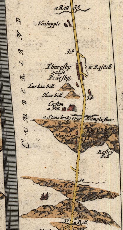 OG96Bm30.jpg In mile 33, Cumberland. "How hill" hillock to the left of the road. item:- JandMN : 22 Image © see bottom of page |
|
|
|
||
| evidence:- | old map:- Bowen 1720 (plate 261) placename:- How Hill |
|
| source data:- | Road strip map, uncoloured engraving, pl.261, the end of the
road from Kendal to Cockermouth and the road from Egremont to
Carlisle, scale about 2 miles to 1 inch, published by Emanuel
Bowen, St Katherines, London, 1720.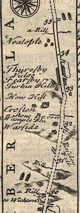 B261m30.jpg At mile 32-33 from Egremont. item:- Dove Cottage : Lowther.36 Image © see bottom of page |
|
|
|
||
 Lakes Guides menu.