 Old Cumbria Gazetteer
 |
 |
|
||
| Horton in Ribblesdale, North Yorkshire | ||||
| Horton in Ribblesdale | ||||
| county:- | North Yorkshire | |||
| locality type:- | locality | |||
| locality type:- | buildings | |||
| coordinates:- | SD81047208 (etc) | |||
| 1Km square:- | SD8172 | |||
| 10Km square:- | SD87 | |||
|
|
||||
| evidence:- | descriptive text:- West 1778 (11th edn 1821) placename:- Horton |
|||
| source data:- | Guide book, A Guide to the Lakes, by Thomas West, published by
William Pennington, Kendal, Cumbria once Westmorland, and in
London, 1778 to 1821. goto source goto sourceTour to the Caves in the West Riding of Yorkshire, late 18th century Page 274:- "..." "... along the banks of the river Ribble, four or five miles farther, to the village of Horton, situated at the bottom of the lofty and elegant mountain Pennegant." goto sourcePage 275:- "..." "Before we left Horton we visited some natural curiosities of the cavern kind on the base of Pennegant.[1] Dowgill-scar, a little above Horton, ... [and] About a mile or two above Horton, upon the base of Pennegant, we visited Hulpit and Huntpit-holes. ..." |
|||
|
|
||||
| evidence:- | old map:- Ford 1839 map placename:- Horton |
|||
| source data:- | Map, uncoloured engraving, Map of the Lake District of
Cumberland, Westmoreland and Lancashire, scale about 3.5 miles
to 1 inch, published by Charles Thurnam, Carlisle, and by R
Groombridge, 5 Paternoster Row, London, 3rd edn 1843.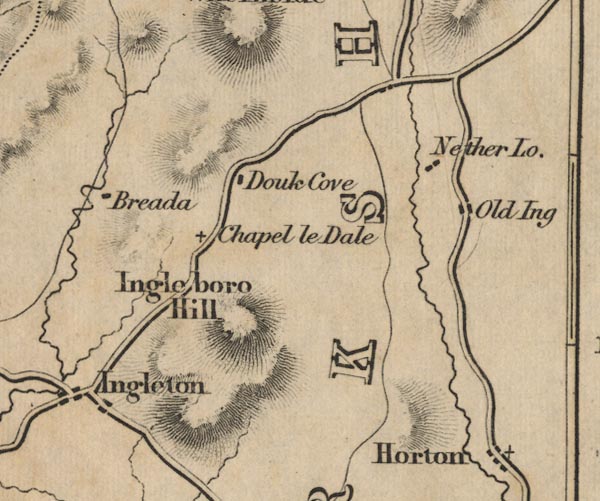 FD02SD77.jpg "Horton" item:- JandMN : 100.1 Image © see bottom of page |
|||
|
|
||||
| places:- |
|
|||
Lakes Guides menu.